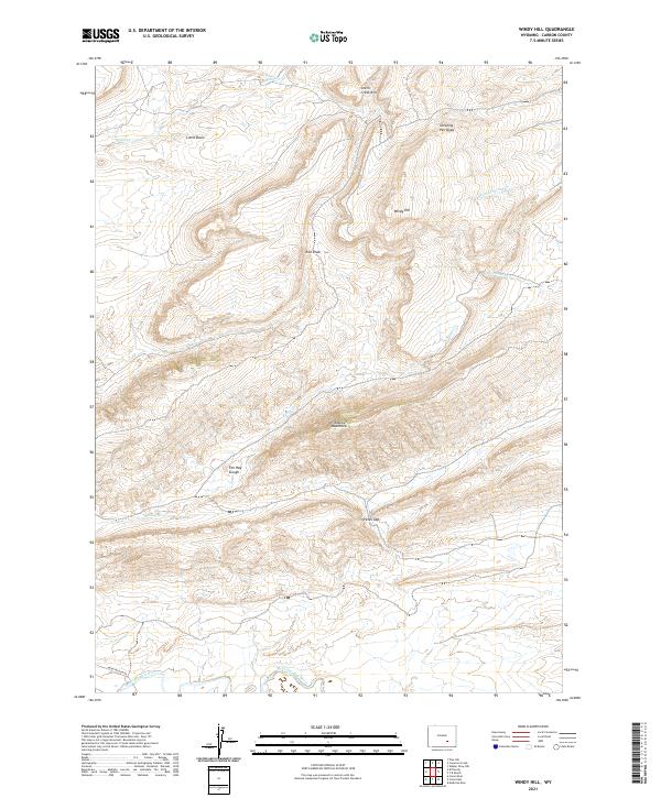
2021 Map of Windy Hill
USGS Topo · Published 2021About this map
The Medicine Bow River winds along the southern edge of this landscape, a critical water source for the surrounding high-desert environment of Carbon County. In the center of the sheet, the Freezeout Mountains rise as a prominent landform, separated from the northern heights of Windy Hill by deep drainages like Red Draw. The presence of the The Hay Slough and various ephemeral streams such as Sledge Cr and Cottonwood Cr indicates a complex drainage system that feeds toward the river basin.
Find a feature on this map
19 named features on this map. Tap any name to fly to it.
Don’t see what you’re looking for? This feature index may not catch every label — zoom into the map to look around manually.
Map Details
Editions of this 2021 Windy Hill Map
This is the sole edition of this map. No revisions or reprints were ever made.
Other maps of this area

1914 · Saddleback Hills
USGS Topo · 1:62,500

1915 · Como Ridge
USGS Topo · 1:48,000

1918 · Como Ridge
USGS Topo · 1:62,500

1921 · Saddleback Hills
USGS Topo · 1:62,500

1954 · Rawlins
USGS Topo · 1:250,000

1955 · Casper
USGS Topo · 1:250,000

1958 · Rawlins
USGS Topo · 1:250,000

1958 · Casper
USGS Topo · 1:250,000
1961 · Pine Hill
USGS Topo · 1:24,000

1961 · T B Ranch
USGS Topo · 1:24,000