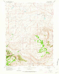
1961 Map of Pine Hill
USGS Topo · Published 1964About this map
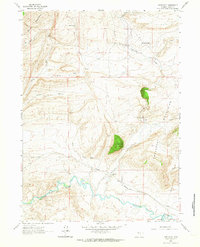
The Shirley Mountains anchor the southwestern portion of this Wyoming landscape, rising above the high-altitude drainage basins of Carbon County. In the early 1960s, this area remained a sparsely populated ranching territory, evidenced by the presence of the Potter Ranch and the distinctive landmark known as The Chimneys. Water management is the primary narrative of this arid terrain, with a network of seasonal and perennial flows including Quealy Creek, Lisenby Creek, and Difficulty Creek defining the livestock range.
Find a feature on this map
23 named features on this map. Tap any name to fly to it.
Don’t see what you’re looking for? This feature index may not catch every label — zoom into the map to look around manually.
Map Details
Editions of this 1961 Pine Hill Map
3 editions found
Other maps of this area

1953 · Fourmile Point
USGS Topo · 1:24,000

1953 · The Q Ranch
USGS Topo · 1:24,000

1953 · T E Ranch
USGS Topo · 1:24,000

1955 · Casper
USGS Topo · 1:250,000

1958 · Casper
USGS Topo · 1:250,000

1960 · Wild Irish Reservoir
USGS Topo · 1:24,000

1960 · Measel Spring Reservoir
USGS Topo · 1:24,000
1961 · Windy Hill
USGS Topo · 1:24,000
1961 · Difficulty
USGS Topo · 1:24,000
1961 · Cameron Creek
USGS Topo · 1:24,000