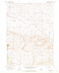
1961 Map of Cameron Creek
USGS Topo · Published 1964About this map
The Freezeout Mountains dominate the southern half of this landscape, rising sharply above the Little Basin and the winding course of Cameron Creek. To the north, the terrain transitions into the more open grazing and water-scarce environments typical of Carbon County, where the Shirley Basin Reservoir and the seasonal Red Lake (Alkali) manage the limited hydraulic resources of the region. This 1961 survey provides a look at the remote ranching infrastructure and land use of the period, evidenced by the presence of the Shamrock Ranch and the Temperley Homestead. The map documents a landscape defined by water sources like Dyer Spring and Smith Creek, essential for the survival of high-desert operations. Human activity is further marked by a small Quarry and a Radio Tower, indicating the slow encroachment of modern utility and industry into the traditional ranchlands of central Wyoming.
Find a feature on this map
16 named features on this map. Tap any name to fly to it.
Don’t see what you’re looking for? This feature index may not catch every label — zoom into the map to look around manually.
Map Details
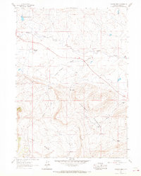
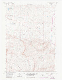
Editions of this 1961 Cameron Creek Map
3 editions found
Other maps of this area

1955 · Casper
USGS Topo · 1:250,000

1958 · Casper
USGS Topo · 1:250,000

1959 · Moss Agate Reservoir
USGS Topo · 1:24,000

1960 · Wild Irish Reservoir
USGS Topo · 1:24,000

1960 · Measel Spring Reservoir
USGS Topo · 1:24,000
1961 · Pine Hill
USGS Topo · 1:24,000

1961 · T B Ranch
USGS Topo · 1:24,000
1961 · Windy Hill
USGS Topo · 1:24,000
1961 · Difficulty
USGS Topo · 1:24,000
1961 · Walker Draw NW
USGS Topo · 1:24,000