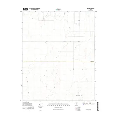
2016 Map of Windy Hill
USGS Topo · Published 2016About this map
The boundary between Dallam Co and Hartley Co bisects this high plains landscape in the northwest corner of the Texas Panhandle. The terrain is characterized by expansive ranch lands and subtle depressions, most notably the Red White and Blue Sand Hills in the southeast corner. This area, dominated by agriculture and livestock operations, is accessed via a network of rural routes such as Ranch Rd 1727 and Bagot Rd. Water resources are sparse, represented by Lake Windmill, which serves as a critical landmark for the surrounding ranching estates. The map reveals the layout of regional properties through roads like Dittle Ranch Rd and Bunker Hill Rd, reflecting the large-scale landholdings common to this portion of the Llano Estacado.
Find a feature on this map
13 named features on this map. Tap any name to fly to it.
Don’t see what you’re looking for? This feature index may not catch every label — zoom into the map to look around manually.
Map Details
Editions of this 2016 Windy Hill Map
This is the sole edition of this map. No revisions or reprints were ever made.
Other maps of this area

1954 · Tucumcari
USGS Topo · 1:250,000

1954 · Dalhart
USGS Topo · 1:250,000

1958 · Tucumcari
USGS Topo · 1:250,000

1958 · Dalhart
USGS Topo · 1:250,000

1962 · Dalhart
USGS Topo · 1:250,000

1970 · Sedan SE
USGS Topo · 1:24,000

1970 · Sedan NE
USGS Topo · 1:24,000

1971 · Koger Ranch
USGS Topo · 1:24,000

1971 · Syndicate Hills
USGS Topo · 1:24,000

1971 · Beck Ranch
USGS Topo · 1:24,000