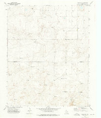
1973 Map of Windy Hill
USGS Topo · Published 1976About this map
Windy Hill rises above the high plains of the Panhandle in this 1973 survey of the borderlands between Dallam Co and Hartley Co. The landscape is defined by the practical necessities of West Texas ranching, where a sparse network of dirt tracks like South Sedan Road connects isolated outposts. Private holdings such as the Bagot Ranch and Martin Ranch anchor the territory, while the survival of livestock is traced through a dense distribution of named water sources. From the Dipping Vat Well to the specialized Red White and Blue Camp Well, these features reveal the logistical infrastructure of mid-century cattle operations. The southern portion of the quadrangle is dominated by the distinctive Red White and Blue Sand Hills, a terrain variation that likely influenced the placement of the many windmills, such as the Steel Windmill, that dot the horizon.
Find a feature on this map
32 named features on this map. Tap any name to fly to it.
Don’t see what you’re looking for? This feature index may not catch every label — zoom into the map to look around manually.
Map Details
Editions of this 1973 Windy Hill Map
This is the sole edition of this map. No revisions or reprints were ever made.
Other maps of this area

1954 · Tucumcari
USGS Topo · 1:250,000

1954 · Dalhart
USGS Topo · 1:250,000

1958 · Tucumcari
USGS Topo · 1:250,000

1958 · Dalhart
USGS Topo · 1:250,000

1962 · Dalhart
USGS Topo · 1:250,000

1970 · Sedan SE
USGS Topo · 1:24,000

1970 · Sedan NE
USGS Topo · 1:24,000

1971 · Koger Ranch
USGS Topo · 1:24,000

1971 · Syndicate Hills
USGS Topo · 1:24,000

1971 · Beck Ranch
USGS Topo · 1:24,000