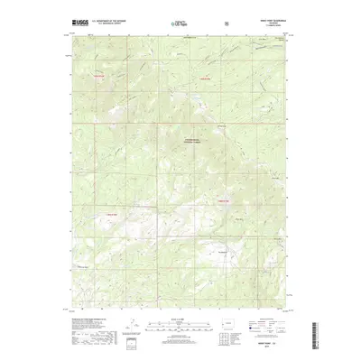
2019 Map of Windy Point
USGS Topo · Published 2019About this map
Uncompahgre National Forest dominates this section of the Uncompahgre Plateau, where a complex network of canyons and high mesas defines the Colorado high country. The landscape is marked by prominent geological features such as Atkinson Bench and Love Mesa, with seasonal drainages like Big Atkinson Cr and Shavano Cr carving through the terrain. Evidence of water management and high-altitude grazing is found at sites like T-Bone Spring and the open area of The Meadows.
Find a feature on this map
36 named features on this map. Tap any name to fly to it.
Don’t see what you’re looking for? This feature index may not catch every label — zoom into the map to look around manually.
Map Details
Editions of this 2019 Windy Point Map
This is the sole edition of this map. No revisions or reprints were ever made.
Other maps of this area

1916 · Paradox Valley
USGS Topo · 1:125,000

1922 · Paradox Valley
USGS Topo · 1:125,000

1948 · Uravan
USGS Topo · 1:24,000

1949 · Uravan
USGS Topo · 1:24,000

1949 · Atkinson Creek
USGS Topo · 1:24,000

1950 · Atkinson Creek
USGS Topo · 1:24,000

1956 · Moab
USGS Topo · 1:250,000

1959 · Moab
USGS Topo · 1:250,000

1960 · Moab
USGS Topo · 1:250,000
1960 · Nucla
USGS Topo · 1:24,000