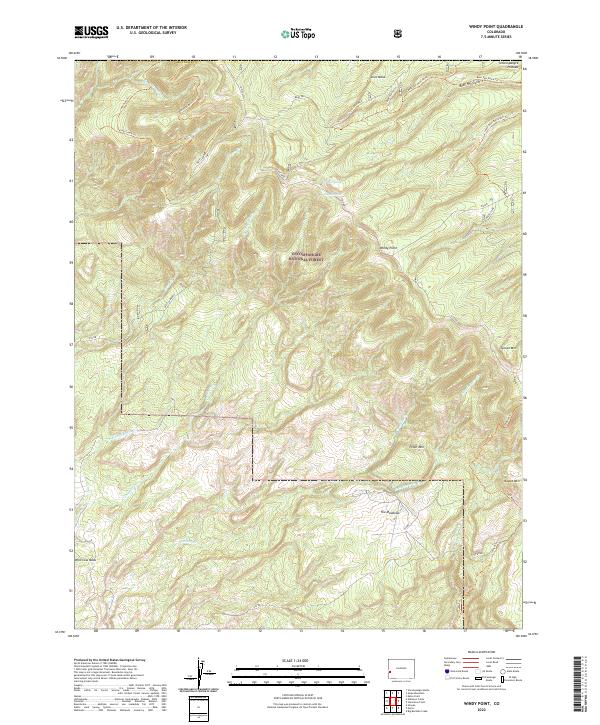
2022 Map of Windy Point
USGS Topo · Published 2022About this map
Uncompahgre National Forest dominates this section of the Uncompahgre Plateau in Montrose County, where a high-desert landscape gives way to complex canyon systems. The terrain is defined by dramatic landforms such as Windy Point, Love Mesa, and Wild Cow Mesa, which overlook a network of seasonal drainages including Big Atkinson Cr and Shavano Cr. A modest settlement at The Meadows represents one of the few named interior landmarks, situated amongst the mesas and mountain peaks like Piñon Mtn.
Find a feature on this map
34 named features on this map. Tap any name to fly to it.
Don’t see what you’re looking for? This feature index may not catch every label — zoom into the map to look around manually.
Map Details
Editions of this 2022 Windy Point Map
This is the sole edition of this map. No revisions or reprints were ever made.
Other maps of this area

1916 · Paradox Valley
USGS Topo · 1:125,000

1922 · Paradox Valley
USGS Topo · 1:125,000

1948 · Uravan
USGS Topo · 1:24,000

1949 · Uravan
USGS Topo · 1:24,000

1949 · Atkinson Creek
USGS Topo · 1:24,000

1950 · Atkinson Creek
USGS Topo · 1:24,000

1956 · Moab
USGS Topo · 1:250,000

1959 · Moab
USGS Topo · 1:250,000

1960 · Moab
USGS Topo · 1:250,000
1960 · Nucla
USGS Topo · 1:24,000