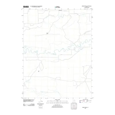
2011 Map of Windy Ridge
USGS Topo · Published 2011About this map
Independence sits at the northern edge of this high desert landscape, where human settlement meets the complex irrigation networks of the Uintah Basin. The Duchesne River meanders sharply through the central portion of the quadrangle, its oxbows and floodplains contrasting with the arid terrain of Windy Ridge and Sand Pass. Water management is central to the area's geography, evidenced by the presence of the South Fork Dry Gulch Canal and the Riverdell Canal, which support agriculture in an otherwise dry environment. A grid of local routes like Independence Rd and Farm To Market Rd connects the scattered rural homesteads and agricultural plots to the small community of Independence, reflecting the region's enduring reliance on river-fed irrigation and ranching.
Find a feature on this map
12 named features on this map. Tap any name to fly to it.
Don’t see what you’re looking for? This feature index may not catch every label — zoom into the map to look around manually.
Map Details
Editions of this 2011 Windy Ridge Map
This is the sole edition of this map. No revisions or reprints were ever made.
Other maps of this area

1885 · Ashley
USGS Topo · 1:250,000

1885 · Uinta
USGS Topo · 1:250,000

1917 · Vernal
USGS Topo · 1:125,000

1939 · Duchesne
USGS Topo · 1:125,000

1954 · Salt Lake City
USGS Topo · 1:250,000

1954 · Vernal
USGS Topo · 1:250,000

1958 · Vernal
USGS Topo · 1:250,000

1958 · Salt Lake City
USGS Topo · 1:250,000

1960 · Salt Lake City
USGS Topo · 1:250,000

1960 · Vernal
USGS Topo · 1:250,000