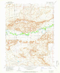
1964 Map of Windy Ridge
USGS Topo · Published 1966About this map
The Duchesne River carves a fertile ribbon of green through the high desert of the Uintah Basin, providing the lifeblood for a complex network of irrigation that defines local settlement. In this mid-1960s landscape, the reliance on water management is evident in the extensive canal systems like the Riverdell Canal, Townsite Canal, and South Lat C Canal, which draw from the river to support the surrounding arid benches. These engineered waterways contrast sharply with the natural erosive features of Windy Ridge and Sand Pass.
Find a feature on this map
19 named features on this map. Tap any name to fly to it.
Don’t see what you’re looking for? This feature index may not catch every label — zoom into the map to look around manually.
Map Details
Editions of this 1964 Windy Ridge Map
This is the sole edition of this map. No revisions or reprints were ever made.
Other maps of this area

1885 · Ashley
USGS Topo · 1:250,000

1885 · Uinta
USGS Topo · 1:250,000

1917 · Vernal
USGS Topo · 1:125,000

1939 · Duchesne
USGS Topo · 1:125,000

1954 · Salt Lake City
USGS Topo · 1:250,000

1954 · Vernal
USGS Topo · 1:250,000

1958 · Vernal
USGS Topo · 1:250,000

1958 · Salt Lake City
USGS Topo · 1:250,000

1960 · Salt Lake City
USGS Topo · 1:250,000

1960 · Vernal
USGS Topo · 1:250,000