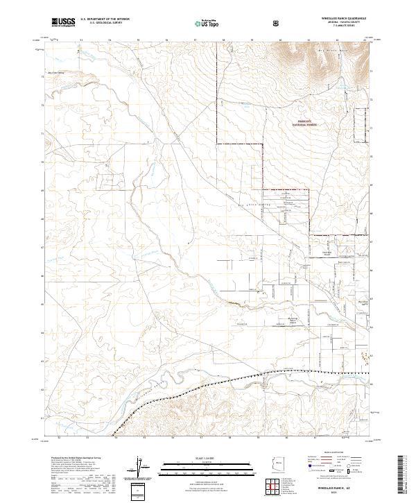
2021 Map of Wineglass Ranch
USGS Topo · Published 2021About this map
Wineglass Ranch and the surrounding high-desert basins of Big Chino Valley define this landscape within the Prescott National Forest. This modern survey illustrates a network of rural development and private airstrips, including Pilots Rest Airport and Big Springs Ranch Airport, reflecting the region's reliance on aviation for connectivity. The drainage patterns of Big Chino Wash and Walnut Creek carve through the terrain beneath the prominent Big Black Mesa. Evidence of ranching infrastructure is frequent, with numerous water catchments like Wineglass Tank and Spring Canyon Tank supporting livestock in a land shaped by the Williamson Valley Wash. The map documents a transition from traditional land use to residential pockets along roads such as Curtis Ranch Rd and Hard Cider Trl.
Find a feature on this map
66 named features on this map. Tap any name to fly to it.
Don’t see what you’re looking for? This feature index may not catch every label — zoom into the map to look around manually.
Map Details
Editions of this 2021 Wineglass Ranch Map
This is the sole edition of this map. No revisions or reprints were ever made.
Other maps of this area

1886 · Chino
USGS Topo · 1:250,000

1887 · Prescott
USGS Topo · 1:250,000

1891 · Chino
USGS Topo · 1:250,000

1892 · Prescott
USGS Topo · 1:250,000

1905 · Jerome
USGS Topo · 1:125,000

1922 · Williams
USGS Topo · 1:125,000

1947 · Ash Fork
USGS Topo · 1:62,500

1947 · Simmons
USGS Topo · 1:62,500

1947 · Picacho Butte
USGS Topo · 1:62,500

1947 · Paulden
USGS Topo · 1:62,500