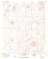
1966 Map of Wing Mountain
USGS Topo · Published 1978About this map
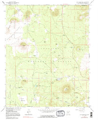
Kaibab National Forest and Coconino National Forest converge in this high-elevation landscape north of the Interstate 40 corridor. The terrain is defined by volcanic activity and open grazing lands, featuring the prominent Wing Mountain and the subterranean Lava River Cave. Water management is the primary sign of human adaptation here, with a dense network of catchment basins such as Wild Bill Tank, Aspen Tank, and Drowned Timber Tank supporting livestock across Government Prairie. Industrial utility is evident near the eastern edge, where Cinder Pits and a pipeline traverse the foothills. Scattered springs, including Maxwell Spring and Pearson Spring, provide rare natural water sources in an otherwise arid timberland. The small settlement at Camp Two on Brannigan Flat suggests the area's history as a base for forest operations or ranching during the mid-20th century.
Find a feature on this map
46 named features on this map. Tap any name to fly to it.
Don’t see what you’re looking for? This feature index may not catch every label — zoom into the map to look around manually.
Map Details
Editions of this 1966 Wing Mountain Map
5 editions found
Other maps of this area

1886 · San Francisco Mtns
USGS Topo · 1:250,000

1891 · San Francisco Mtns
USGS Topo · 1:250,000

1894 · San Francisco Mtns
USGS Topo · 1:250,000

1899 · San Francisco Mtns
USGS Topo · 1:250,000

1908 · Flagstaff
USGS Topo · 1:125,000

1912 · Flagstaff
USGS Topo · 1:125,000

1947 · Flagstaff
USGS Topo · 1:250,000

1954 · Flagstaff
USGS Topo · 1:250,000

1958 · Flagstaff
USGS Topo · 1:250,000

1960 · Flagstaff
USGS Topo · 1:250,000