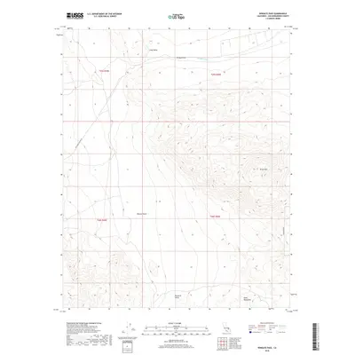
2018 Map of Wingate Pass
USGS Topo · Published 2018About this map
Wingate Pass serves as a critical geographic threshold between the high-elevation terrain of the Quail Mountains and the lower reaches of Panamint Valley. This 2018 survey documents a region defined by its extreme topography, where the seasonal drainage of Wingate Wash cuts through the desert landscape. To the north, Long Valley and Brown Mtn dominate the horizon, while the southern portion of the map transitions into the vast Mojave Desert. The sparse infrastructure consists primarily of isolated desert tracks, including New York Canyon Rd and Goldstone Rd, which highlight the area's role as a remote corridor through the California desert.
Find a feature on this map
14 named features on this map. Tap any name to fly to it.
Don’t see what you’re looking for? This feature index may not catch every label — zoom into the map to look around manually.
Map Details
Editions of this 2018 Wingate Pass Map
This is the sole edition of this map. No revisions or reprints were ever made.
Other maps of this area

1915 · Searles Lake
USGS Topo · 1:250,000

1933 · Avawatz Mountains
USGS Topo · 1:250,000

1947 · Trona
USGS Topo · 1:250,000

1948 · Trona
USGS Topo · 1:250,000

1948 · Quail Mountains
USGS Topo · 1:62,500

1950 · Manly Peak
USGS Topo · 1:62,500

1950 · Wingate Wash
USGS Topo · 1:62,500

1950 · Wingate Pass
USGS Topo · 1:62,500

1951 · Wingate Pass
USGS Topo · 1:62,500

1951 · Quail Mountains
USGS Topo · 1:62,500