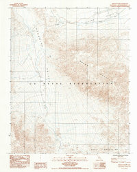
1984 Map of Wingate Pass
USGS Topo · Published 1984About this map
Wingate Pass serves as a critical geographic gateway in this high-desert landscape of the early 1980s, where the Panamint Valley meets the rising elevations of the Brown Mountain range. Much of the southern and central portion of this survey is defined by the U S Naval Reservation, indicating the area's ongoing military significance during the Cold War era. The terrain is marked by dramatic elevation changes, flowing from the expansive Long Valley in the northeast down toward the Quail Mountains. Evidence of industrial history is found in the Old Railroad Grade, which skirts the northern edge of the pass, tracing a terrestrial transport route through a land otherwise dominated by seasonal drainage features like the Wash. This provisional manuscript drawing captures a transition point between natural desert wilderness and restricted federal land use.
Find a feature on this map
8 named features on this map. Tap any name to fly to it.
Don’t see what you’re looking for? This feature index may not catch every label — zoom into the map to look around manually.
Map Details
Editions of this 1984 Wingate Pass Map
This is the sole edition of this map. No revisions or reprints were ever made.
Other maps of this area

1915 · Searles Lake
USGS Topo · 1:250,000

1933 · Avawatz Mountains
USGS Topo · 1:250,000

1947 · Trona
USGS Topo · 1:250,000

1948 · Trona
USGS Topo · 1:250,000

1948 · Quail Mountains
USGS Topo · 1:62,500

1950 · Manly Peak
USGS Topo · 1:62,500

1950 · Wingate Wash
USGS Topo · 1:62,500

1950 · Wingate Pass
USGS Topo · 1:62,500

1951 · Wingate Pass
USGS Topo · 1:62,500

1951 · Quail Mountains
USGS Topo · 1:62,500