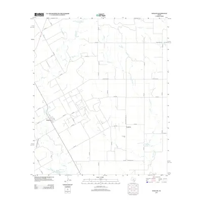
2012 Map of Wingate
USGS Topo · Published 2012About this map
Valley Cr and Fish Cr meander through this West Texas landscape, framing the small settlement of Wingate, which sits at the intersection of local roads including 1st St and 4th St. The area is defined by its agricultural and water management infrastructure, evidenced by the presence of Soil Conservation Service Site 16 Reservoir and Soil Conservation Service Site 18 Reservoir. To the east, the community of Pumphrey and its associated Pumphrey Cem mark the rural landscape alongside Big Coyote Cr. A network of ranch and farm roads, such as Ranch Road 2595 and Farm-To-Market Road 383, connects these disparate points of interest across the plains. Genealogists and local historians can use this survey to pinpoint family landmarks near Mitchell Lake and along the numerous branches of Salt Br.
Find a feature on this map
49 named features on this map. Tap any name to fly to it.
Don’t see what you’re looking for? This feature index may not catch every label — zoom into the map to look around manually.
Map Details
Editions of this 2012 Wingate Map
This is the sole edition of this map. No revisions or reprints were ever made.
Other maps of this area

1890 · Abilene
USGS Topo · 1:125,000

1891 · Hayrick
USGS Topo · 1:125,000

1892 · Abilene
USGS Topo · 1:125,000

1892 · Ballinger
USGS Topo · 1:125,000

1893 · Sweetwater
USGS Topo · 1:125,000

1894 · Hayrick
USGS Topo · 1:125,000

1954 · Brownwood
USGS Topo · 1:250,000

1954 · Big Spring
USGS Topo · 1:250,000

1954 · Abilene
USGS Topo · 1:250,000

1954 · San Angelo
USGS Topo · 1:250,000