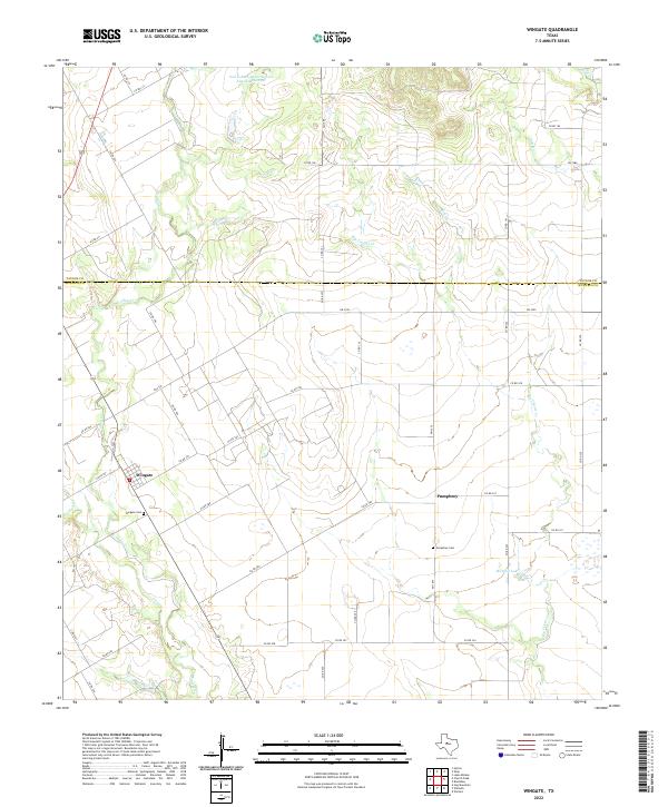
2022 Map of Wingate
USGS Topo · Published 2022About this map
Wingate and Pumphrey anchor this portion of the West Texas landscape, straddling the boundary between Taylor and Runnels counties. The area is defined by a dendritic network of intermittent streams, including Valley Creek and Fish Creek, which drain toward the south. This modern survey illustrates a rural environment shaped by land management and local history, where small settlements are often centered around their community burial grounds, such as Wingate Cem and Pumphrey Cem. The presence of the Soil Conservation Service Site 16 Reservoir and Mitchell Lake highlights the importance of water storage in this arid region. A dense grid of county roads, such as Co RD 308 and Co RD 328, reveals a persistent agricultural and ranching infrastructure that has organized the terrain into distinct, manageable blocks over decades of settlement.
Find a feature on this map
46 named features on this map. Tap any name to fly to it.
Don’t see what you’re looking for? This feature index may not catch every label — zoom into the map to look around manually.
Map Details
Editions of this 2022 Wingate Map
This is the sole edition of this map. No revisions or reprints were ever made.
Other maps of this area

1890 · Abilene
USGS Topo · 1:125,000

1891 · Hayrick
USGS Topo · 1:125,000

1892 · Abilene
USGS Topo · 1:125,000

1892 · Ballinger
USGS Topo · 1:125,000

1893 · Sweetwater
USGS Topo · 1:125,000

1894 · Hayrick
USGS Topo · 1:125,000

1954 · Brownwood
USGS Topo · 1:250,000

1954 · Big Spring
USGS Topo · 1:250,000

1954 · Abilene
USGS Topo · 1:250,000

1954 · San Angelo
USGS Topo · 1:250,000