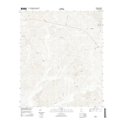
2014 Map of Winn
USGS Topo · Published 2014About this map
Clarksville and the surrounding Clarke County countryside are defined by a complex network of creeks and small family or church burial grounds. In the north, Saint Lukes Cem and Clarksville Cem sit just off Revelation Rd, while Zimco marks a junction further southeast. The landscape is deeply dissected by the winding courses of Tattilaba Cr and Dodey Cr, which dictate the paths of rural routes like Dodey Creek Rd. This 2014 survey reveals a settlement pattern focused on small crossroads and dispersed homesites rather than centralized urban growth. Genealogists will find a high density of rural cemeteries, including Austin Cem, Pleasant Grove Cem, and Bumpers Cem, many tucked away on secondary roads such as Old Mill Pond Rd and Guys Fish Pond Rd. The southern reach of the quadrangle is anchored by the community of Winn, situated near the headwaters of Jackson Cr.
Find a feature on this map
35 named features on this map. Tap any name to fly to it.
Don’t see what you’re looking for? This feature index may not catch every label — zoom into the map to look around manually.
Map Details
Editions of this 2014 Winn Map
This is the sole edition of this map. No revisions or reprints were ever made.
Other maps of this area

1953 · Andalusia
USGS Topo · 1:250,000

1953 · Hattiesburg
USGS Topo · 1:250,000

1957 · Andalusia
USGS Topo · 1:250,000

1958 · Hattiesburg
USGS Topo · 1:250,000

1971 · Coffeeville
USGS Topo · 1:24,000

1972 · Tattlersville
USGS Topo · 1:24,000

1972 · St. Stephens
USGS Topo · 1:24,000

1978 · Jackson
USGS Topo · 1:24,000

1978 · McEntyre
USGS Topo · 1:24,000

1978 · Winn
USGS Topo · 1:24,000