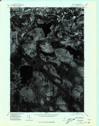
1975 Map of Winn SE
USGS Topo · Published 1980About this map
Moose Mountain dominates the southern landscape of this orthophotoquad, a specialized cartographic product that merges the photographic detail of aerial imagery with the precision of topographic mapping. Unlike traditional line-and-tint maps, this 1975 survey provides a raw visual record of the dense Maine woodlands and the intricate patterns of its wetlands and water bodies. The imagery reveals the varied texture of the forest floor and the stark outlines of several unnamed lakes and ponds characteristic of the Penobscot region. The presence of logging tracks and winding rural roads cutting through the timberland illustrates the area's ongoing relationship with the forestry industry, offering a clear view of the land-use patterns and natural drainage systems before further modern development or reforestation altered the terrain.
Find a feature on this map
1 named feature on this map. Tap any name to fly to it.
Don’t see what you’re looking for? This feature index may not catch every label — zoom into the map to look around manually.
Map Details
Editions of this 1975 Winn SE Map
This is the sole edition of this map. No revisions or reprints were ever made.
Other maps of this area

1920 · Winn
USGS Topo · 1:62,500

1931 · Springfield
USGS Topo · 1:48,000

1931 · Saponac
USGS Topo · 1:48,000

1932 · Nicatous Lake
USGS Topo · 1:48,000

1934 · Saponac
USGS Topo · 1:62,500

1934 · Nicatous Lake
USGS Topo · 1:62,500

1934 · Springfield
USGS Topo · 1:62,500

1954 · Millinocket
USGS Topo · 1:250,000

1957 · Saponac
USGS Topo · 1:62,500

1958 · Millinocket
USGS Topo · 1:250,000