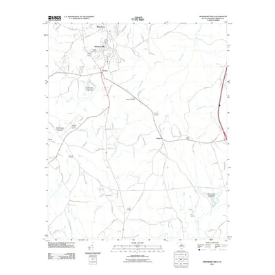
2011 Map of Winnsboro Mills
USGS Topo · Published 2011About this map
Winnsboro Mills and the neighboring community of Rockton serve as the focal point for this Fairfield County study, illustrating the residential and industrial footprint of the region's textile history. The landscape is marked by numerous family and community burial grounds, including the Winnsboro Mills Cemetery, Thomas Woodward Cemetery, and the New Buffalo Cemetery, providing essential data for genealogical research. To the west, the Fairfield County Airport and the settlement of Rion define the outskirts of the town, while the eastern portion of the map is dominated by the drainages of Horse Creek and Dutchmans Creek. The terrain is punctuated by significant infrastructure such as the Simpson Lookout Tower near Simpson and several numbered water control structures, including the South Carolina Noname 2010 D-0527 Dam.
Find a feature on this map
100 named features on this map. Tap any name to fly to it.
Don’t see what you’re looking for? This feature index may not catch every label — zoom into the map to look around manually.
Map Details
Editions of this 2011 Winnsboro Mills Map
This is the sole edition of this map. No revisions or reprints were ever made.
Other maps of this area

1904 · Columbia
USGS Topo · 1:125,000

1935 · Killian
USGS Topo · 1:48,000

1937 · Killian
USGS Topo · 1:62,500

1941 · Spartanburg
USGS Topo · 1:250,000

1942 · Camden
USGS Topo · 1:125,000

1947 · Richtex
USGS Topo · 1:24,000

1949 · Richtex
USGS Topo · 1:24,000

1949 · Irmo NE
USGS Topo · 1:24,000

1953 · Blythewood
USGS Topo · 1:24,000

1953 · Spartanburg
USGS Topo · 1:250,000