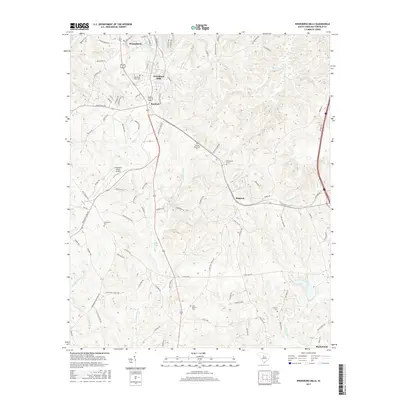
2017 Map of Winnsboro Mills
USGS Topo · Published 2017About this map
Winnsboro Mills and the railroad settlement of Rockton anchor this Fairfield County landscape, which transitions from the historic textile mill district of south Winnsboro into the timbered drainage of the Little Cedar Cr watershed. The area’s genealogical record is well-preserved through numerous family and community burial grounds, such as the Thomas Woodward Cem and Richardson Cem. The presence of the Fairfield County Airport and the expanding footprint of Blythewood at the southern edge indicate the modern shift toward regional aviation and suburban growth, yet the map retains the underlying structure of its rural past. Waterways like Dutchmans Cr and Big Cedar Cr define the rolling topography, while named corridors like Old 21 and Kincaid Bridge Rd follow long-established transport routes through the Piedmont hills.
Find a feature on this map
97 named features on this map. Tap any name to fly to it.
Don’t see what you’re looking for? This feature index may not catch every label — zoom into the map to look around manually.
Map Details
Editions of this 2017 Winnsboro Mills Map
This is the sole edition of this map. No revisions or reprints were ever made.
Other maps of this area

1904 · Columbia
USGS Topo · 1:125,000

1935 · Killian
USGS Topo · 1:48,000

1937 · Killian
USGS Topo · 1:62,500

1941 · Spartanburg
USGS Topo · 1:250,000

1942 · Camden
USGS Topo · 1:125,000

1947 · Richtex
USGS Topo · 1:24,000

1949 · Richtex
USGS Topo · 1:24,000

1949 · Irmo NE
USGS Topo · 1:24,000

1953 · Blythewood
USGS Topo · 1:24,000

1953 · Spartanburg
USGS Topo · 1:250,000