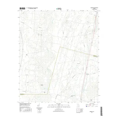
2017 Map of Winokur
USGS Topo · Published 2017About this map
Winokur stands at the eastern edge of a vast, water-logged landscape defined by the Little Okefenokee Swamp and the drainage of Buffalo Creek. This 2017 survey illustrates the complex hydrology of the Georgia coastal plain, where elevated features like Trail Ridge provide dry ground amidst a network of wetlands including Cross Swamp and Big Bay. The map reveals a pattern of land use where islands and hammocks, such as Briar Island and White Oak Hammock, serve as distinct points of higher elevation within the surrounding marsh. A dense network of local roads, many named for resident families like Radal Crews Rd, Samuel Crews Rd, and Mac Crews Rd, suggests a landscape shaped by generations of forestry and agricultural heritage straddling the boundary between Brantley and Charlton counties.
Find a feature on this map
40 named features on this map. Tap any name to fly to it.
Don’t see what you’re looking for? This feature index may not catch every label — zoom into the map to look around manually.
Map Details
Editions of this 2017 Winokur Map
This is the sole edition of this map. No revisions or reprints were ever made.
Other maps of this area

1917 · Nahunta
USGS Topo · 1:62,500

1917 · Boulogne
USGS Topo · 1:62,500

1918 · Folkston
USGS Topo · 1:62,500

1918 · Nahunta
USGS Topo · 1:62,500

1919 · Boulogne
USGS Topo · 1:62,500

1946 · Brunswick
USGS Topo · 1:250,000

1948 · Jacksonville
USGS Topo · 1:250,000

1948 · Brunswick
USGS Topo · 1:250,000

1953 · Waycross
USGS Topo · 1:250,000

1954 · Valdosta
USGS Topo · 1:250,000