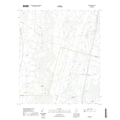
2020 Map of Winokur
USGS Topo · Published 2020About this map
The settlement of Winokur stands at the eastern edge of a landscape defined by the drainage systems of Buffalo Creek and Little Buffalo Creek. This South Georgia terrain is characterized by the prominent Trail Ridge and an intricate network of wetlands, including the Little Okefenokee Swamp and Cross Swamp. The area's geography is marked by numerous elevated "islands" and dense vegetation patches such as Briar Island, Warren Island, and Dark Thick, which provided natural boundaries and limited development areas within the marshy surroundings.
Find a feature on this map
42 named features on this map. Tap any name to fly to it.
Don’t see what you’re looking for? This feature index may not catch every label — zoom into the map to look around manually.
Map Details
Editions of this 2020 Winokur Map
This is the sole edition of this map. No revisions or reprints were ever made.
Other maps of this area

1917 · Nahunta
USGS Topo · 1:62,500

1917 · Boulogne
USGS Topo · 1:62,500

1918 · Folkston
USGS Topo · 1:62,500

1918 · Nahunta
USGS Topo · 1:62,500

1919 · Boulogne
USGS Topo · 1:62,500

1946 · Brunswick
USGS Topo · 1:250,000

1948 · Jacksonville
USGS Topo · 1:250,000

1948 · Brunswick
USGS Topo · 1:250,000

1953 · Waycross
USGS Topo · 1:250,000

1954 · Valdosta
USGS Topo · 1:250,000