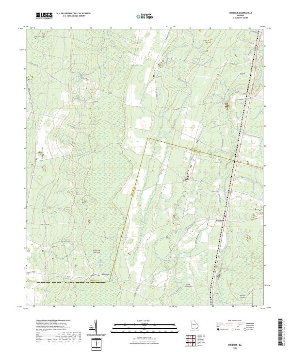
2024 Map of Winokur
USGS Topo · Published 2024About this map
Winokur stands as a primary settlement point in this Southeast Georgia landscape, situated along the corridor of the Little Buffalo Creek. The terrain is defined by the extensive wetlands of the Little Okefenokee Swamp and the prominent geological feature of Trail Ridge, which influences the local drainage and vegetation patterns. This 2024 survey documents the persistence of traditional hammocks and "islands"—slightly elevated ground within the wetlands—such as White Oak Hammock, Cedar Hammocks, and Briar Island. The network of rural roads, including the Winokur-Mattox Rd and Samuel Crews Rd, reflects a history of family-named landmarks and local connectivity through the dense swamp systems of Cross Swamp and Big Bay. The border between Brantley and Charlton counties cuts through these lowlands, marking political divisions in a largely hydrologically-driven environment.
Find a feature on this map
40 named features on this map. Tap any name to fly to it.
Don’t see what you’re looking for? This feature index may not catch every label — zoom into the map to look around manually.
Map Details
Editions of this 2024 Winokur Map
This is the sole edition of this map. No revisions or reprints were ever made.
Other maps of this area

1917 · Nahunta
USGS Topo · 1:62,500

1917 · Boulogne
USGS Topo · 1:62,500

1918 · Folkston
USGS Topo · 1:62,500

1918 · Nahunta
USGS Topo · 1:62,500

1919 · Boulogne
USGS Topo · 1:62,500

1946 · Brunswick
USGS Topo · 1:250,000

1948 · Jacksonville
USGS Topo · 1:250,000

1948 · Brunswick
USGS Topo · 1:250,000

1953 · Waycross
USGS Topo · 1:250,000

1954 · Valdosta
USGS Topo · 1:250,000