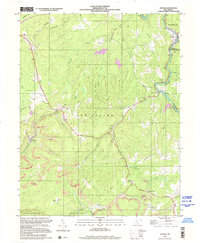
2000 Map of Winona
USGS Topo · Published 2001About this map
Winona and the surrounding plateau of Fayette County are defined here by a complex landscape of coal extraction and deep river gorges. The southern portion of the map is dominated by the northern reaches of Babcock State Park, where Manns Creek carves through the terrain near the settlement of Clifftop. Further north, the Meadow River serves as the county boundary, winding past the village of Nallen and the Russellville landing.
Find a feature on this map
53 named features on this map. Tap any name to fly to it.
Don’t see what you’re looking for? This feature index may not catch every label — zoom into the map to look around manually.
Map Details
Editions of this 2000 Winona Map
This is the sole edition of this map. No revisions or reprints were ever made.
Other maps of this area

1887 · Hinton
USGS Topo · 1:125,000

1889 · Nicholas
USGS Topo · 1:125,000

1891 · Nicholas
USGS Topo · 1:125,000

1891 · Raleigh
USGS Topo · 1:125,000

1892 · Hinton
USGS Topo · 1:125,000

1897 · Kanawha Falls
USGS Topo · 1:125,000

1897 · Raleigh
USGS Topo · 1:125,000

1900 · Kanawha Falls
USGS Topo · 1:125,000

1901 · Nicholas
USGS Topo · 1:125,000

1901 · Kanawha Falls
USGS Topo · 1:125,000