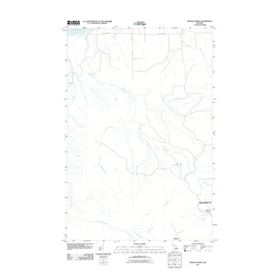
2011 Map of Winona North
USGS Topo · Published 2011About this map
Misery Bay on the southern shore of Lake Superior anchors this survey of Michigan's Copper Country. The landscape is defined by a dense network of watercourses, including the Misery River and its various tributaries such as the North Branch Misery River and Little Misery River, which snake through the timbered terrain. Settlement is concentrated toward the southern boundary at Wyandotte and Winona, where the terrain transitions from the coastal lowlands to the higher ground of the Keweenaw Peninsula. Local recreation and geography are marked by the Wyandotte Hills Golf Course and the natural drop of Wyandotte Falls. Further north, Camp 18 and Pine Dam Lake represent the area's logging and water management history, reached via the transit corridor of Misery Bay Rd.
Find a feature on this map
23 named features on this map. Tap any name to fly to it.
Don’t see what you’re looking for? This feature index may not catch every label — zoom into the map to look around manually.
Map Details
Editions of this 2011 Winona North Map
This is the sole edition of this map. No revisions or reprints were ever made.
Other maps of this area

1950 · Greenland
USGS Topo · 1:62,500

1951 · Greenland
USGS Topo · 1:62,500

1954 · Graveraet River
USGS Topo · 1:24,000

1954 · Rockhouse Point
USGS Topo · 1:24,000

1954 · Winona
USGS Topo · 1:62,500

1958 · Hancock
USGS Topo · 1:250,000

1958 · Iron River
USGS Topo · 1:250,000

1960 · Iron River
USGS Topo · 1:250,000

1960 · Hancock
USGS Topo · 1:250,000

1961 · Iron River
USGS Topo · 1:250,000