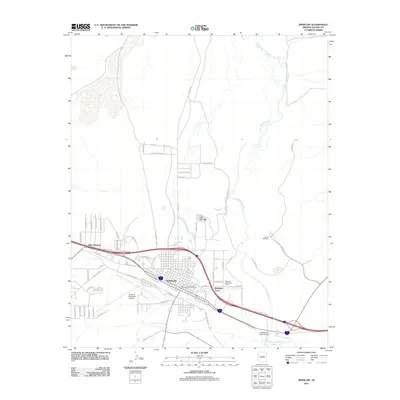
2011 Map of Winslow
USGS Topo · Published 2011About this map
The Winslow townsite and its surrounding high-desert infrastructure are documented in detail on this 2011 survey. Centered on the crossroads of the historic Old Hwy 66 and newer transport corridors, the landscape illustrates the continued development of this northern Arizona hub. The Little Colorado River meanders across the northeast, while the Winslow Municipal Airport and the residential expansion of Bushman Acres define the southern and eastern edges of town. Small landmarks with deep local ties are captured, including Whipple Memorial Park and Sunset Cemetery, alongside traces of earlier pathways like the Morman Trl. The map effectively shows how the modern town layout interacts with natural features like Cottonwood Wash and Tucker Spring, providing a clear picture of the region's mid-century growth and early 21st-century footprint.
Find a feature on this map
59 named features on this map. Tap any name to fly to it.
Don’t see what you’re looking for? This feature index may not catch every label — zoom into the map to look around manually.
Map Details
Editions of this 2011 Winslow Map
This is the sole edition of this map. No revisions or reprints were ever made.
Other maps of this area

1883 · Tusayan
USGS Topo · 1:250,000

1886 · Tusayan
USGS Topo · 1:250,000

1886 · Holbrook
USGS Topo · 1:250,000

1893 · Holbrook
USGS Topo · 1:250,000

1947 · Flagstaff
USGS Topo · 1:250,000

1954 · Winslow
USGS Topo · 1:62,500

1954 · Winslow 4 NW
USGS Topo · 1:24,000

1954 · Winslow 4 SW
USGS Topo · 1:24,000

1954 · Winslow 4 SE
USGS Topo · 1:24,000

1954 · Winslow 4 NE
USGS Topo · 1:24,000