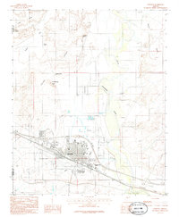
1986 Map of Winslow
USGS Topo · Published 1986About this map
Winslow sits at the heart of this high-desert landscape, anchored by the significant rail infrastructure of the Atchison Topeka and Santa Fe railroad. The grid of the city is positioned just west of the Little Colorado River, which meanders through the eastern portion of the map. The arrival of education and modern infrastructure is evidenced by the campus of Northland Pioneer College and the sprawling Municipal Airport to the south.
Find a feature on this map
25 named features on this map. Tap any name to fly to it.
Don’t see what you’re looking for? This feature index may not catch every label — zoom into the map to look around manually.
Map Details
Editions of this 1986 Winslow Map
This is the sole edition of this map. No revisions or reprints were ever made.
Other maps of this area

1883 · Tusayan
USGS Topo · 1:250,000

1886 · Tusayan
USGS Topo · 1:250,000

1886 · Holbrook
USGS Topo · 1:250,000

1893 · Holbrook
USGS Topo · 1:250,000

1947 · Flagstaff
USGS Topo · 1:250,000

1954 · Winslow
USGS Topo · 1:62,500

1954 · Winslow 4 NW
USGS Topo · 1:24,000

1954 · Winslow 4 SW
USGS Topo · 1:24,000

1954 · Winslow 4 SE
USGS Topo · 1:24,000

1954 · Winslow 4 NE
USGS Topo · 1:24,000