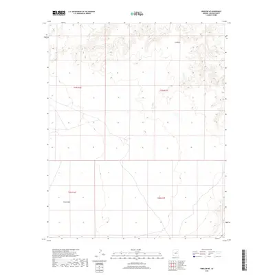
2018 Map of Winslow NE
USGS Topo · Published 2018About this map
Ives Mesa dominates the northern skyline of this Navajo County landscape, defined by a series of high, finger-like ridges and deep drainage channels. This 2018 survey illustrates a sparsely settled high-desert environment where the vast Rincon Basin opens up to the south. The map provides a detailed view of the Public Land Survey System grid across T21N R16E and T20N R17E, showing how the arid terrain dictates the path of local roads and unimproved trails. While devoid of named settlements, the geographic relationship between the mesa and the basin below reveals the natural flow of water across this portion of the Fort Defiance Agency region.
Find a feature on this map
6 named features on this map. Tap any name to fly to it.
Don’t see what you’re looking for? This feature index may not catch every label — zoom into the map to look around manually.
Map Details
Editions of this 2018 Winslow NE Map
This is the sole edition of this map. No revisions or reprints were ever made.
Other maps of this area

1883 · Tusayan
USGS Topo · 1:250,000

1886 · Tusayan
USGS Topo · 1:250,000

1947 · Flagstaff
USGS Topo · 1:250,000

1954 · Winslow
USGS Topo · 1:62,500

1954 · Winslow 4 NW
USGS Topo · 1:24,000

1954 · Winslow 4 SW
USGS Topo · 1:24,000

1954 · Winslow 4 SE
USGS Topo · 1:24,000

1954 · Winslow 4 NE
USGS Topo · 1:24,000

1954 · Flagstaff
USGS Topo · 1:250,000

1955 · Mal Pais Springs 3 SW
USGS Topo · 1:24,000