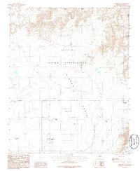
1986 Map of Winslow NE
USGS Topo · Published 1986About this map
Navajo Indian Reservation lands dominate this mid-1980s landscape, which centers on the wide, arid depressions of the Rincon Basin. The terrain is defined by its dependency on water management in an environment where natural surface water is scarce. A network of livestock water sources, including Blue Wash Tank, Clints Tank, and the Old Corral Tank, indicates the continued importance of ranching across these high plains. To the north, the sharp rise of Ives Mesa provides a stark topographical boundary, overlooking a region marked by isolated infrastructure like the lone Corral and the Reservation Tank near the township lines. This survey captures a specific snapshot of land use on the reservation, where the distribution of tanks reveals the vital points of human and animal activity in the basin.
Find a feature on this map
10 named features on this map. Tap any name to fly to it.
Don’t see what you’re looking for? This feature index may not catch every label — zoom into the map to look around manually.
Map Details
Editions of this 1986 Winslow NE Map
This is the sole edition of this map. No revisions or reprints were ever made.
Other maps of this area

1883 · Tusayan
USGS Topo · 1:250,000

1886 · Tusayan
USGS Topo · 1:250,000

1947 · Flagstaff
USGS Topo · 1:250,000

1954 · Winslow
USGS Topo · 1:62,500

1954 · Winslow 4 NW
USGS Topo · 1:24,000

1954 · Winslow 4 SW
USGS Topo · 1:24,000

1954 · Winslow 4 SE
USGS Topo · 1:24,000

1954 · Winslow 4 NE
USGS Topo · 1:24,000

1954 · Flagstaff
USGS Topo · 1:250,000

1955 · Mal Pais Springs 3 SW
USGS Topo · 1:24,000