
Loading...
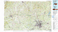
Loading map...1955 Map of Winston-Salem
USGS Topo · Published 1955About this map
Winston-Salem serves as the urban anchor for this mid-century survey of the Central Blue Ridge, where the Piedmont's rolling industry meets the high country of North Carolina, Virginia, and Tennessee. The Yadkin River and Dan River drain the eastern slopes, while the New River carves through the ancient plateaus to the north. This era marks the prominence of the Blue Ridge Parkway and the Appalachian Trail as they trace the crests near Mount Rogers and White Top Mountain.
Find a feature on this map
285 named features on this map. Tap any name to fly to it.
Don’t see what you’re looking for? This feature index may not catch every label — zoom into the map to look around manually.
Map Details
Date Portrayed1955
Date Published1955
PublisherU.S. Geological Survey
Map TypeTopographic
Scale1:250000
Physical Dimensions32.06 x 22.88 inches
Editions of this 1955 Winston-Salem Map
This is the sole edition of this map. No revisions or reprints were ever made.
Historical Maps of Dobson Forest Through Time
4 maps found


Featured Locations
Source Details
SourceU.S. Geological Survey
CopyrightPublic Domain