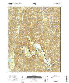
2019 Map of Winterpock
USGS Topo · Published 2019About this map
The Appomattox River winds through this region, forming the reservoir of Lake Chesdin where it meets Goose Island. The landscape is defined by its many tributary systems, including Winterpock Creek and Nooning Creek, which carve through the undulating terrain of south-central Virginia. The settlement of Winterpock serves as a central point for local heritage, situated near several significant burial grounds such as Centenary Cem and Bethia Cem.
Find a feature on this map
90 named features on this map. Tap any name to fly to it.
Don’t see what you’re looking for? This feature index may not catch every label — zoom into the map to look around manually.
Map Details
Editions of this 2019 Winterpock Map
This is the sole edition of this map. No revisions or reprints were ever made.
Other maps of this area

1897 · Amelia
USGS Topo · 1:125,000

1943 · Chesterfield
USGS Topo · 1:31,680

1943 · Goodes Bridge
USGS Topo · 1:31,680

1943 · Hallsboro
USGS Topo · 1:31,680

1943 · Beach
USGS Topo · 1:24,000

1943 · Clayville
USGS Topo · 1:24,000

1943 · Church Road
USGS Topo · 1:24,000

1943 · Winterpock
USGS Topo · 1:24,000

1943 · Sutherland
USGS Topo · 1:24,000

1943 · Richmond
USGS Topo · 1:250,000