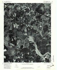
1979 Map of Winterpock
USGS Topo · Published 1982About this map
Winterpock sits at the heart of this 1979 orthophotograph, a moment in time when the landscape of southern Chesterfield County was a dense mosaic of woodland and active agricultural clearings. The southern boundary is defined by the sweeping, serpentine curves of the Appomattox River as it feeds into the wide expanse of Lake Chesdin. This aerial perspective, prepared by the U.S. Geological Survey and the Soil Conservation Service, reveals the intricate drainage patterns of the region, including the headwaters of Winterpock Creek and Winticoma Creek. The imagery provides a clear look at the rural road network and individual homesteads before the significant suburban expansion of later decades, showing a transition where traditional land use met the growing water management needs of the region.
Find a feature on this map
7 named features on this map. Tap any name to fly to it.
Don’t see what you’re looking for? This feature index may not catch every label — zoom into the map to look around manually.
Map Details
Editions of this 1979 Winterpock Map
This is the sole edition of this map. No revisions or reprints were ever made.
Other maps of this area

1897 · Amelia
USGS Topo · 1:125,000

1943 · Chesterfield
USGS Topo · 1:31,680

1943 · Goodes Bridge
USGS Topo · 1:31,680

1943 · Hallsboro
USGS Topo · 1:31,680

1943 · Beach
USGS Topo · 1:24,000

1943 · Clayville
USGS Topo · 1:24,000

1943 · Church Road
USGS Topo · 1:24,000

1943 · Winterpock
USGS Topo · 1:24,000

1943 · Sutherland
USGS Topo · 1:24,000

1943 · Richmond
USGS Topo · 1:250,000