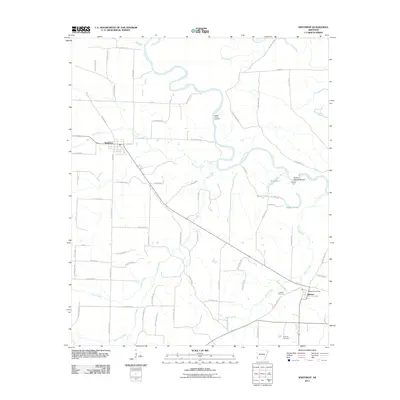
2011 Map of Winthrop
USGS Topo · Published 2011About this map
The Little River meanders through this portion of Little River County, defining a landscape of wetlands and water crossings in the early 21st century. River navigation and access points remain central to the geography here, evidenced by landmarks such as Yellow Banks Landing, Hawkins Ford, and Cotton Woods Shoals. These features point to a long history of utilizing the river's winding course for transport and local industry. To the west, the town of Winthrop serves as a local hub, while the smaller community of Alleene to the southeast contains vital local infrastructure including the Alleene Post Office. The area is interlaced with numerous named waterways like Hurricane Creek, Flat Creek, and Wards Creek, which feed into the primary river system. Genealogists can find significant local history at the Alleene Cemetery and Freeman Cemetery, which provide connections to the families who settled this southwestern Arkansas river country.
Find a feature on this map
79 named features on this map. Tap any name to fly to it.
Don’t see what you’re looking for? This feature index may not catch every label — zoom into the map to look around manually.
Map Details
Editions of this 2011 Winthrop Map
This is the sole edition of this map. No revisions or reprints were ever made.
Other maps of this area

1950 · Ashdown West
USGS Topo · 1:24,000

1950 · Falls Chapel
USGS Topo · 1:24,000

1950 · Winthrop
USGS Topo · 1:24,000

1951 · Winthrop
USGS Topo · 1:24,000

1951 · Ashdown West
USGS Topo · 1:24,000

1951 · Falls Chapel
USGS Topo · 1:24,000

1951 · Arden
USGS Topo · 1:24,000

1951 · Arkinda
USGS Topo · 1:24,000

1951 · Cerrogordo
USGS Topo · 1:24,000

1951 · Horatio
USGS Topo · 1:24,000