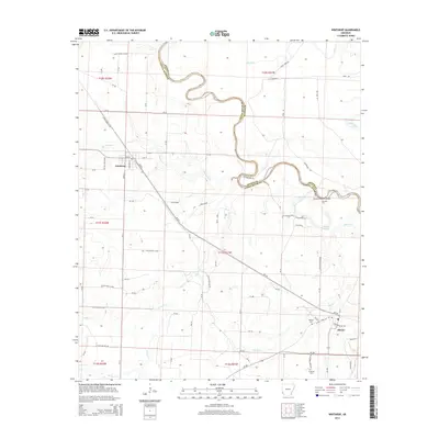
2014 Map of Winthrop
USGS Topo · Published 2014About this map
Winthrop and Alleene serve as the primary hubs in this southwest Arkansas landscape, situated where the Arkansas and Oklahoma borderlands meet. The topography is defined by the winding course of the Little River, which forms the boundary between Sevier and Little River counties. Along its banks, the map identifies specific river crossings and natural features such as Hawkins Ford and Cotton Woods Shoals, providing evidence of historical transit routes before modern infrastructure became dominant.
Find a feature on this map
87 named features on this map. Tap any name to fly to it.
Don’t see what you’re looking for? This feature index may not catch every label — zoom into the map to look around manually.
Map Details
Editions of this 2014 Winthrop Map
This is the sole edition of this map. No revisions or reprints were ever made.
Other maps of this area

1950 · Ashdown West
USGS Topo · 1:24,000

1950 · Falls Chapel
USGS Topo · 1:24,000

1950 · Winthrop
USGS Topo · 1:24,000

1951 · Winthrop
USGS Topo · 1:24,000

1951 · Ashdown West
USGS Topo · 1:24,000

1951 · Falls Chapel
USGS Topo · 1:24,000

1951 · Arden
USGS Topo · 1:24,000

1951 · Arkinda
USGS Topo · 1:24,000

1951 · Cerrogordo
USGS Topo · 1:24,000

1951 · Horatio
USGS Topo · 1:24,000