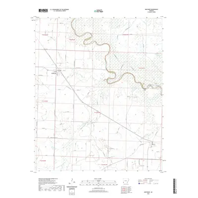
2020 Map of Winthrop
USGS Topo · Published 2020About this map
Winthrop and Alleene serve as the primary anchors of this Little River County landscape, where the meandering Little River carves a complex boundary between Sevier and Little River counties. The river's winding course is marked by distinctive natural features such as Cotton Woods Shoals and the nearby Boggy Slough. This modern survey reveals a highly organized network of local routes, including the legacy of timber or rail transport seen in Tram Rd and specialized paths like Little River Trail and Red Lake Trail. For genealogists and local historians, the map identifies specific burial sites like Alleene Cem and Freeman Cem, while the intricate drainage patterns of Hurricane Cr, Wards Cr, and Pond Cr provide a clear view of the hydrological character of the region as it exists today.
Find a feature on this map
87 named features on this map. Tap any name to fly to it.
Don’t see what you’re looking for? This feature index may not catch every label — zoom into the map to look around manually.
Map Details
Editions of this 2020 Winthrop Map
This is the sole edition of this map. No revisions or reprints were ever made.
Other maps of this area

1950 · Ashdown West
USGS Topo · 1:24,000

1950 · Falls Chapel
USGS Topo · 1:24,000

1950 · Winthrop
USGS Topo · 1:24,000

1951 · Winthrop
USGS Topo · 1:24,000

1951 · Ashdown West
USGS Topo · 1:24,000

1951 · Falls Chapel
USGS Topo · 1:24,000

1951 · Arden
USGS Topo · 1:24,000

1951 · Arkinda
USGS Topo · 1:24,000

1951 · Cerrogordo
USGS Topo · 1:24,000

1951 · Horatio
USGS Topo · 1:24,000