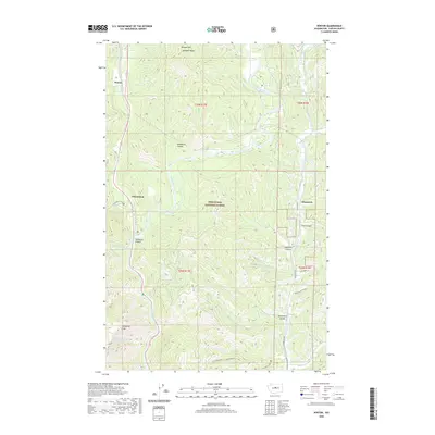
2020 Map of Winton
USGS Topo · Published 2020About this map
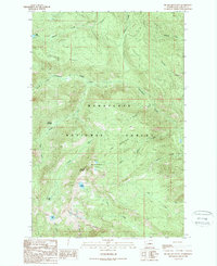
The Wenatchee River carves a deep path through the center of this terrain, defining the local geography between the high peaks of the Wenatchee National Forest. Small settlements such as Winton and Chiwaukum are established along the river's course, while Chumstick sits to the east along the valley floor. The landscape is characterized by its dramatic vertical relief, from the heights of Natapoc Mtn and Josephine Crag down to the deeply incised Tumwater Canyon. This 2020 edition provides a clear picture of how historical roads like Chumstick Rd follow the natural drainage patterns of Chumstick Cr. The distribution of canyons, including Sunitsch Canyon and Spramberg Canyon, indicates the complex network of seasonal and perennial creeks that feed the primary river system, supporting the region's forestry and transportation corridors.
Find a feature on this map
32 named features on this map. Tap any name to fly to it.
Don’t see what you’re looking for? This feature index may not catch every label — zoom into the map to look around manually.
Map Details
Editions of this 2020 Winton Map
This is the sole edition of this map. No revisions or reprints were ever made.
Other maps of this area

1901 · Chiwaukum
USGS Topo · 1:125,000

1904 · Chiwaukum
USGS Topo · 1:125,000

1957 · Wenatchee
USGS Topo · 1:250,000

1964 · Leavenworth
USGS Topo · 1:62,500

1965 · Chiwaukum Mts
USGS Topo · 1:62,500

1965 · Wenatchee Lake
USGS Topo · 1:62,500
1968 · Sugarloaf Peak
USGS Topo · 1:24,000
1968 · Plain
USGS Topo · 1:24,000
1975 · Chelan
USGS Topo · 1:100,000
1989 · Big Jim Mountain
USGS Topo · 1:24,000