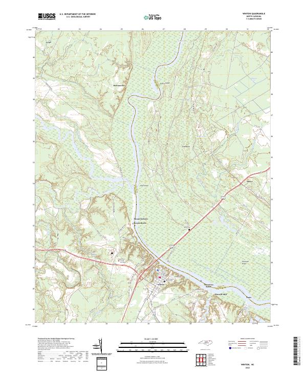
2022 Map of Winton
USGS Topo · Published 2022About this map
The Hertford County Courthouse serves as the focal point for the town of Winton, situated along the southern banks of the Chowan River. This 2022 survey captures a landscape defined by the confluence of major waterways, where the Meherrin River and Potecasi Creek merge into the Chowan. The riverfront character is evident through established recreational and residential areas such as Chowan Beach and Tuscarora Beach, alongside more industrial and historic landings like Tunis and Harrells Mill.
Find a feature on this map
70 named features on this map. Tap any name to fly to it.
Don’t see what you’re looking for? This feature index may not catch every label — zoom into the map to look around manually.
Map Details
Editions of this 2022 Winton Map
This is the sole edition of this map. No revisions or reprints were ever made.
Other maps of this area

1908 · Winton
USGS Topo · 1:62,500

1919 · Boykins
USGS Topo · 1:48,000

1920 · Holland
USGS Topo · 1:62,500

1920 · Boykins
USGS Topo · 1:62,500

1943 · Holland
USGS Topo · 1:62,500

1953 · Norfolk
USGS Topo · 1:250,000

1957 · Holland
USGS Topo · 1:62,500

1966 · Sunbeam
USGS Topo · 1:24,000
1967 · Gates
USGS Topo · 1:24,000
1967 · Riverdale
USGS Topo · 1:24,000