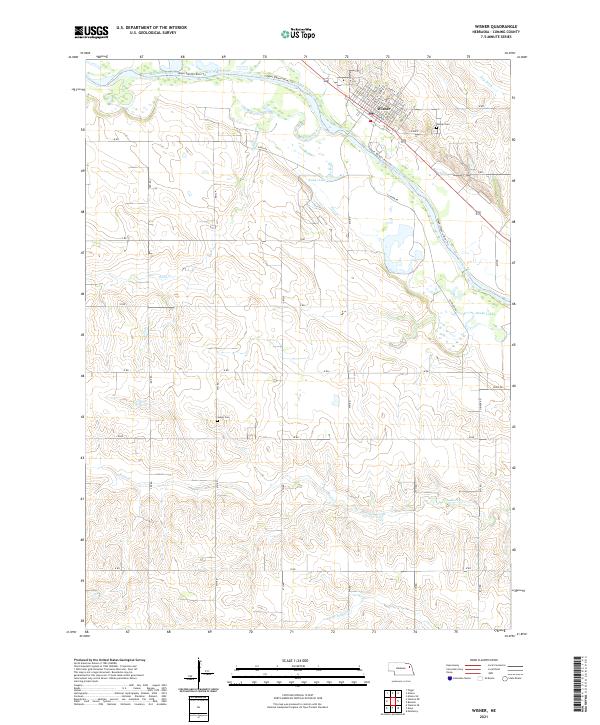
2021 Map of Wisner
USGS Topo · Published 2021About this map
Wisner anchors this landscape in Cuming County, situated along the northern bank of the Elkhorn River. The town's grid is detailed down to residential avenues and streets, including Avenue E and 10th St N, while the surrounding countryside is defined by the agricultural section lines of the Nebraska plains. The hydrology of the area is particularly complex, featuring numerous oxbows and water bodies such as Kanes Lake and Raabe Lake that trace the shifting path of the river over time.
Find a feature on this map
49 named features on this map. Tap any name to fly to it.
Don’t see what you’re looking for? This feature index may not catch every label — zoom into the map to look around manually.
Map Details
Editions of this 2021 Wisner Map
This is the sole edition of this map. No revisions or reprints were ever made.
Other maps of this area

1955 · Sioux City
USGS Topo · 1:250,000

1955 · Fremont
USGS Topo · 1:250,000

1957 · Fremont
USGS Topo · 1:250,000

1958 · Sioux City
USGS Topo · 1:250,000

1958 · Fremont
USGS Topo · 1:250,000

1959 · Sioux City
USGS Topo · 1:250,000

1963 · Pilger
USGS Topo · 1:24,000

1963 · Wisner
USGS Topo · 1:24,000

1963 · Altona
USGS Topo · 1:24,000
1963 · Stanton NE
USGS Topo · 1:24,000