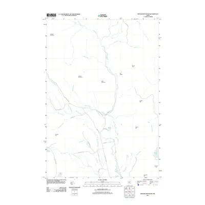
2011 Map of Witham Mountain
USGS Topo · Published 2011About this map
Sandy Stream and its numerous tributaries, including Barker Brook and Michael Stream, dominate this interior Maine landscape. The terrain is defined by a series of prominent summits such as Witham Mountain, Bald Mountain, and Stewart Mountain. The road network provides evidence of the area's utility and history, with names like Hard Scrabble Rd and Last Round Up Rd suggesting the character of local life and land use. Small bodies of water are tucked between these heights, including Moores Pond and Butler Pond, while The Ledges stands out as a distinctive geological landmark along the eastern bank of the main stream. This survey records a workspace of brooks and ridges, where Schoolhouse Brook hints at former community centers in an area otherwise characterized by timberlands and winding mountain roads.
Find a feature on this map
43 named features on this map. Tap any name to fly to it.
Don’t see what you’re looking for? This feature index may not catch every label — zoom into the map to look around manually.
Map Details
Editions of this 2011 Witham Mountain Map
This is the sole edition of this map. No revisions or reprints were ever made.
Other maps of this area

1903 · Bingham
USGS Topo · 1:62,500

1904 · Anson
USGS Topo · 1:62,500

1905 · Bingham
USGS Topo · 1:62,500

1928 · Dead River
USGS Topo · 1:62,500

1930 · Kingfield
USGS Topo · 1:48,000

1931 · Dead River
USGS Topo · 1:48,000

1932 · Kingfield
USGS Topo · 1:62,500

1944 · Dead River
USGS Topo · 1:62,500

1948 · Bangor
USGS Topo · 1:250,000

1949 · Jackman
USGS Topo · 1:250,000
Featured Places
- Kingfield, ME
- Pleasant Ridge Plantation, ME
- Highland Plantation, ME
- Concord Township, ME
- Lexington Township, ME