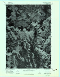
1979 Map of Witham Mountain
USGS Topo · Published 1983About this map
Witham Mountain anchors this 1979 orthophotograph of the Maine woods, where the high-elevation terrain is defined by dramatic ridgelines and watercourses. Unlike traditional topographic maps, this aerial imagery reveals the precise texture of the forest cover and the winding path of Sandy Stream as it cuts through the valley. The convergence of Michael Stream and smaller tributaries like Barker Brook illustrates the natural drainage patterns of this upland region. Landforms such as Peaked Hill stand out as clear navigational landmarks in an area otherwise dominated by dense timber and seasonal runoff channels. This document provides a direct visual record of the forest density and land use in Somerset County just before the 1980s, offering a clear view of the logging roads and clearings that mark the era's timber industry.
Find a feature on this map
5 named features on this map. Tap any name to fly to it.
Don’t see what you’re looking for? This feature index may not catch every label — zoom into the map to look around manually.
Map Details
Editions of this 1979 Witham Mountain Map
This is the sole edition of this map. No revisions or reprints were ever made.
Other maps of this area

1903 · Bingham
USGS Topo · 1:62,500

1904 · Anson
USGS Topo · 1:62,500

1905 · Bingham
USGS Topo · 1:62,500

1928 · Dead River
USGS Topo · 1:62,500

1930 · Kingfield
USGS Topo · 1:48,000

1931 · Dead River
USGS Topo · 1:48,000

1932 · Kingfield
USGS Topo · 1:62,500

1944 · Dead River
USGS Topo · 1:62,500

1948 · Bangor
USGS Topo · 1:250,000

1949 · Jackman
USGS Topo · 1:250,000
Featured Places
- Kingfield, ME
- Pleasant Ridge Plantation, ME
- Highland Plantation, ME
- Lexington Township, ME
- Concord Township, ME