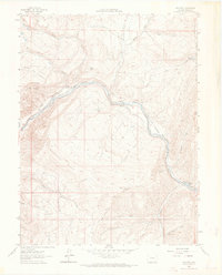
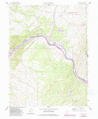
1962 Map of Wolcott
USGS Topo · Published 1970About this map
Wolcott sits at a strategic bend of the Eagle River in the early 1960s, serving as a focal point for the canyon's transportation and irrigation networks. The Denver and Rio Grande Western railroad tracks parallel the river's course through Red Canyon, highlighting the importance of this corridor for regional transit. The landscape is defined by the significant elevation gain toward Bellyache Ridge and Bocco Mtn, with the valley floor dominated by ranching infrastructure.
Find a feature on this map
34 named features on this map. Tap any name to fly to it.
Don’t see what you’re looking for? This feature index may not catch every label — zoom into the map to look around manually.
Map Details
Editions of this 1962 Wolcott Map
6 editions found
Other maps of this area

1957 · Leadville
USGS Topo · 1:250,000

1959 · Leadville
USGS Topo · 1:250,000

1960 · Leadville
USGS Topo · 1:250,000

1962 · Leadville
USGS Topo · 1:250,000

1962 · Grouse Mountain
USGS Topo · 1:24,000

1962 · Fulford
USGS Topo · 1:24,000

1962 · Wolcott
USGS Topo · 1:24,000

1962 · Eagle
USGS Topo · 1:24,000

1962 · Edwards
USGS Topo · 1:24,000
1962 · The Seven Hermits
USGS Topo · 1:24,000