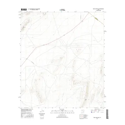
2016 Map of Wolf Camp Hills
USGS Topo · Published 2016About this map
The Wolf Camp Hills dominate the northwestern landscape of this Trans-Pecos region, where high desert elevations meet the complex drainage systems of the eastern Glass Mountains. This 2016 survey captures a territory defined by large-scale ranching and intermittent watercourses, such as the winding path of San Francisco Cr and the more isolated Frog Cr to the east. High points like Stillwell Mtn provide significant vertical relief, illustrating the geologic transition across the county line between Pecos and Brewster counties. The road network is sparse, centered on private ranch access via Brooks Ranch Rd and Kincaid Ranch Rd, reflecting the enduring isolation of this West Texas rangeland in the early 21st century.
Find a feature on this map
7 named features on this map. Tap any name to fly to it.
Don’t see what you’re looking for? This feature index may not catch every label — zoom into the map to look around manually.
Map Details
Editions of this 2016 Wolf Camp Hills Map
This is the sole edition of this map. No revisions or reprints were ever made.
Other maps of this area

1920 · Longfellow
USGS Topo · 1:125,000

1920 · Marathon
USGS Topo · 1:62,500

1921 · Marathon
USGS Topo · 1:62,500

1923 · Hess Canyon
USGS Topo · 1:62,500

1954 · Fort Stockton
USGS Topo · 1:250,000

1958 · Fort Stockton
USGS Topo · 1:250,000

1968 · Housetop Mountains
USGS Topo · 1:24,000

1968 · Marathon Gap
USGS Topo · 1:24,000

1968 · Dimple Hills
USGS Topo · 1:24,000

1973 · Fort Stockton
USGS Topo · 1:250,000