
Loading...
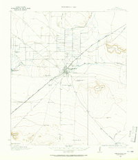
Loading map...1973 Map of Fort Stockton
USGS Topo · Published 1974About this map
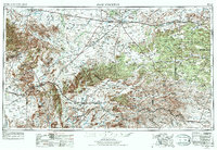
Fort Stockton serves as the focal point of this Trans-Pecos landscape, situated at the junction of US Highway 290 and US Highway 285. The map documents the vast ranching and energy landscape of the early 1970s, dotted with windmills and gas fields across the Stockton Plateau. To the west, the high elevations of the Davis Mountains provide a dramatic vertical contrast, hosting the Fort Davis Nat Hist Site and Davis Mts State Park near the town of Alpine.
Find a feature on this map
134 named features on this map. Tap any name to fly to it.
Don’t see what you’re looking for? This feature index may not catch every label — zoom into the map to look around manually.
Map Details
Date Portrayed1973
Date Published1974
PublisherU.S. Geological Survey
Map TypeTopographic
Scale1:250,000
Physical Dimensions33.6 x 22.1 inches
Editions of this 1973 Fort Stockton Map
This is the sole edition of this map. No revisions or reprints were ever made.
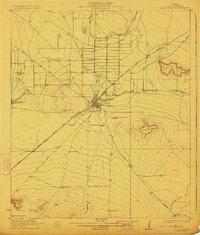
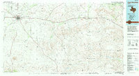
Historical Maps of Fort Stockton Through Time
6 maps found

Featured Locations
Source Details
SourceU.S. Geological Survey
CopyrightPublic Domain