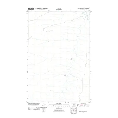
2011 Map of Wolf Creek Falls
USGS Topo · Published 2011About this map
Wolf Creek Falls serves as a central landmark in this portion of Fergus County, where the high plains are carved by a network of drainage systems. The landscape is defined by the convergence of several waterways, including Clydes Creek and Wolf Creek, which flow toward the Judith River at the northeastern corner of the map. This terrain illustrates the characteristic erosion patterns of the region, where deep draws like Coyote Coulee and Falls Coulee cut through the open country. The presence of Bear Springs Bench suggests a rise in the local topography, while Bear Springs Rd provides the primary overland access through this sparsely developed area. The map focuses on the natural hydrology and elevation changes that dictate the movement of water and travelers alike in this part of Montana.
Find a feature on this map
8 named features on this map. Tap any name to fly to it.
Don’t see what you’re looking for? This feature index may not catch every label — zoom into the map to look around manually.
Map Details
Editions of this 2011 Wolf Creek Falls Map
This is the sole edition of this map. No revisions or reprints were ever made.
Other maps of this area

1953 · Starve Out Flat
USGS Topo · 1:24,000

1954 · P N Ranch
USGS Topo · 1:24,000

1954 · Council Island
USGS Topo · 1:24,000

1954 · Lewistown
USGS Topo · 1:250,000

1959 · Lewistown
USGS Topo · 1:250,000

1964 · Wolf Creek Falls
USGS Topo · 1:24,000

1964 · Anderson Bridge
USGS Topo · 1:24,000

1964 · Spring Coulee
USGS Topo · 1:24,000
1978 · Soda Spring Coulee
USGS Topo · 1:24,000

1978 · Wild Bill Flat West
USGS Topo · 1:24,000