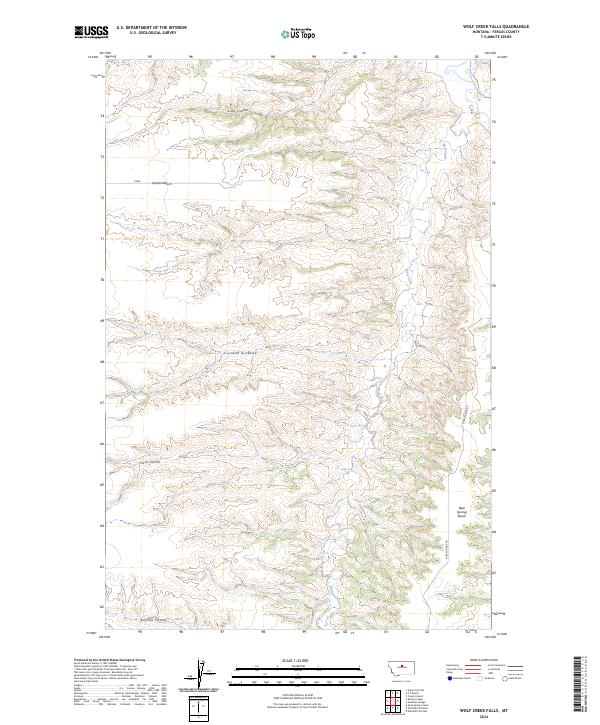
2024 Map of Wolf Creek Falls
USGS Topo · Published 2024About this map
Upper Missouri River Breaks National Monument defines the northeastern corner of this Fergus County landscape, where the high plains break into a complex system of drainage coulees. The terrain is characterized by broad elevated flats such as Everson Bench and Bear Springs Bench, which drop sharply into deeply carved seasonal waterways including King Coulee and Coyote Coulee. Wolf Creek serves as the primary drainage through the eastern portion of the sheet, leading to the notable Wolf Creek Falls. This modern survey illustrates the persistent rural character of the region, where infrastructure is limited to routes like Bear Springs Rd and the township and range lines that still dictate land management across the breaks.
Find a feature on this map
15 named features on this map. Tap any name to fly to it.
Don’t see what you’re looking for? This feature index may not catch every label — zoom into the map to look around manually.
Map Details
Editions of this 2024 Wolf Creek Falls Map
This is the sole edition of this map. No revisions or reprints were ever made.
Other maps of this area

1953 · Starve Out Flat
USGS Topo · 1:24,000

1954 · P N Ranch
USGS Topo · 1:24,000

1954 · Council Island
USGS Topo · 1:24,000

1954 · Lewistown
USGS Topo · 1:250,000

1959 · Lewistown
USGS Topo · 1:250,000

1964 · Wolf Creek Falls
USGS Topo · 1:24,000

1964 · Anderson Bridge
USGS Topo · 1:24,000

1964 · Spring Coulee
USGS Topo · 1:24,000
1978 · Soda Spring Coulee
USGS Topo · 1:24,000

1978 · Wild Bill Flat West
USGS Topo · 1:24,000