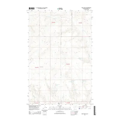
2014 Map of Wolf Point NE
USGS Topo · Published 2014About this map
Tule Cr and its western drainage, the W-Fork Tule Cr, define this landscape in the Roosevelt County portion of the Fort Peck Indian Reservation. This 2014 survey reveals a sparse, rural environment dominated by a complex network of ephemeral waterways and springs, including 28N48E30ACCC01 Spring and 28N48E28AADD01 Spring. The terrain is marked by deep drainage features like Brown Coulee, which cuts through the southern sections of the township. Local transportation is limited to a grid of county roads such as Windy Hill Rd and Hillview Rd, which provide access across the high plains. In the far southwest corner, Little Wolf Cr marks the divide towards the Missouri River valley, showing the characteristic geographic transition of this high plains region.
Find a feature on this map
26 named features on this map. Tap any name to fly to it.
Don’t see what you’re looking for? This feature index may not catch every label — zoom into the map to look around manually.
Map Details
Editions of this 2014 Wolf Point NE Map
This is the sole edition of this map. No revisions or reprints were ever made.
Other maps of this area

1910 · Cuskers
USGS Topo · 1:62,500

1912 · Chelsea
USGS Topo · 1:62,500

1915 · Tule Valley
USGS Topo · 1:62,500

1915 · Cuskers
USGS Topo · 1:62,500

1916 · Wolf Point
USGS Topo · 1:62,500

1954 · Wolf Point
USGS Topo · 1:250,000

1958 · Wolf Point
USGS Topo · 1:250,000

1972 · Chelsea SW
USGS Topo · 1:24,000

1972 · Wolf Point
USGS Topo · 1:24,000

1972 · Macon
USGS Topo · 1:24,000