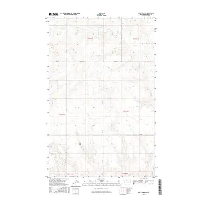
2017 Map of Wolf Point NE
USGS Topo · Published 2017About this map
Brown Coulee carves through this northern Montana landscape, where the drainage systems of W Fork Tule Cr and Tule Cr define the local topography. This 2017 survey shows a region largely organized by the Public Land Survey System, with township and range lines like t29n r47e and t28n r48e providing the structural framework for the land. The road network is sparse, consisting primarily of gravel and local routes such as Windy Hill Rd and Benrud Rd, which connect remote ranching or agricultural sites. In the southern portion of the quadrangle, the headwaters of Little Wolf Cr emerge, cutting through the elevation changes typical of the Missouri River plateau. The map serves as a contemporary record of the open plains of the Wolf Point District, illustrating how modern infrastructure follows the natural contours of the coulees and creek beds.
Find a feature on this map
17 named features on this map. Tap any name to fly to it.
Don’t see what you’re looking for? This feature index may not catch every label — zoom into the map to look around manually.
Map Details
Editions of this 2017 Wolf Point NE Map
This is the sole edition of this map. No revisions or reprints were ever made.
Other maps of this area

1910 · Cuskers
USGS Topo · 1:62,500

1912 · Chelsea
USGS Topo · 1:62,500

1915 · Tule Valley
USGS Topo · 1:62,500

1915 · Cuskers
USGS Topo · 1:62,500

1916 · Wolf Point
USGS Topo · 1:62,500

1954 · Wolf Point
USGS Topo · 1:250,000

1958 · Wolf Point
USGS Topo · 1:250,000

1972 · Chelsea SW
USGS Topo · 1:24,000

1972 · Wolf Point
USGS Topo · 1:24,000

1972 · Macon
USGS Topo · 1:24,000