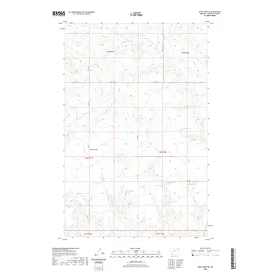
2020 Map of Wolf Point NE
USGS Topo · Published 2020About this map
W Fork Tule Cr and Tule Cr define the drainage patterns of this corner of Roosevelt County, Montana. The landscape is characterized by its numerous natural water sources, including the 29N47E26BDCA01 Spring and 28N48E09DDCC01 Spring, which reflect the region's reliance on groundwater in the high plains. The terrain is marked by significant topographical shifts near Brown Coulee and along the banks of Little Wolf Cr. This 2020 edition provides a clear record of the rural road network, with arteries like Windy Hill Rd and Benrud Rd traversing the township and range divisions. The distribution of named springs such as 28N48E28BBBD01 Spring and 28N48E28AADD01 Spring offers valuable points of reference for those studying historical water rights and ranching boundaries in the Wolf Point district.
Find a feature on this map
25 named features on this map. Tap any name to fly to it.
Don’t see what you’re looking for? This feature index may not catch every label — zoom into the map to look around manually.
Map Details
Editions of this 2020 Wolf Point NE Map
This is the sole edition of this map. No revisions or reprints were ever made.
Other maps of this area

1910 · Cuskers
USGS Topo · 1:62,500

1912 · Chelsea
USGS Topo · 1:62,500

1915 · Tule Valley
USGS Topo · 1:62,500

1915 · Cuskers
USGS Topo · 1:62,500

1916 · Wolf Point
USGS Topo · 1:62,500

1954 · Wolf Point
USGS Topo · 1:250,000

1958 · Wolf Point
USGS Topo · 1:250,000

1972 · Chelsea SW
USGS Topo · 1:24,000

1972 · Wolf Point
USGS Topo · 1:24,000

1972 · Macon
USGS Topo · 1:24,000