
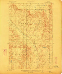
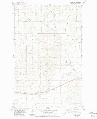
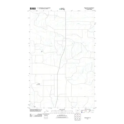
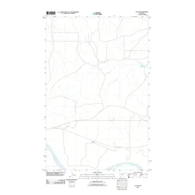
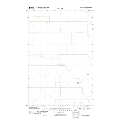
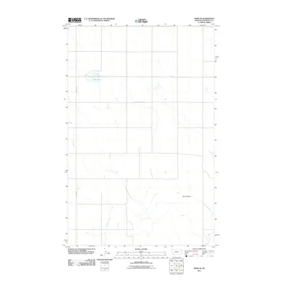
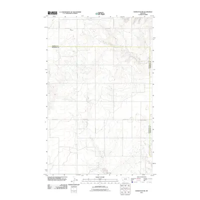
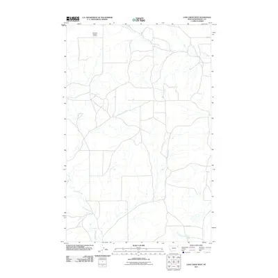
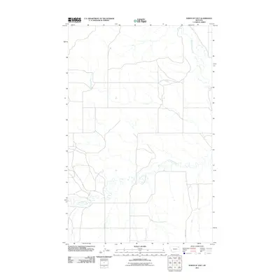
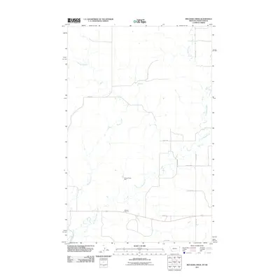
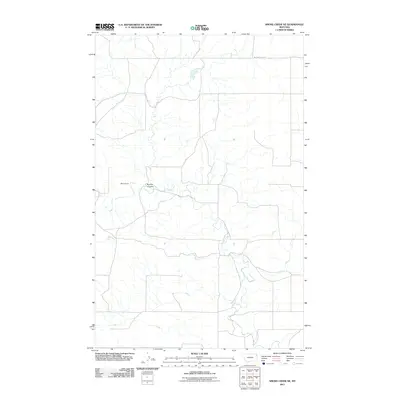
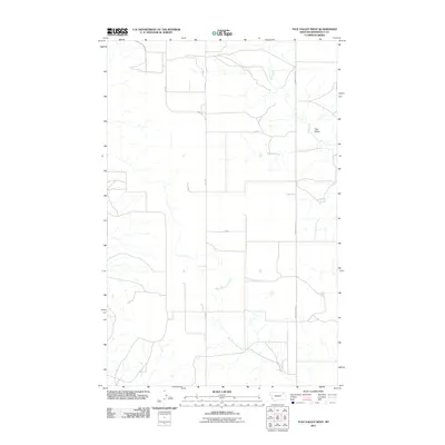
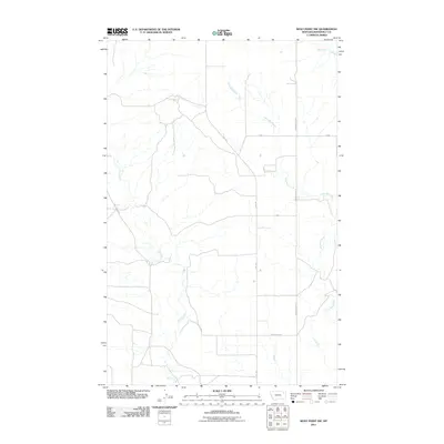
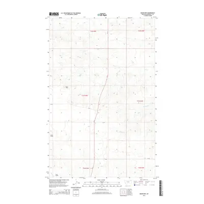
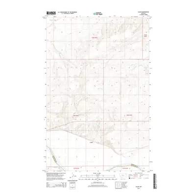
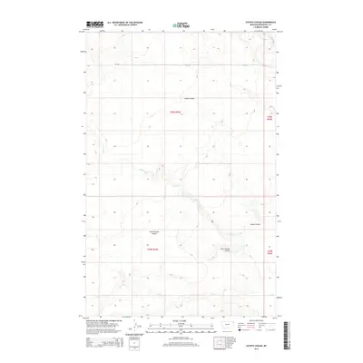
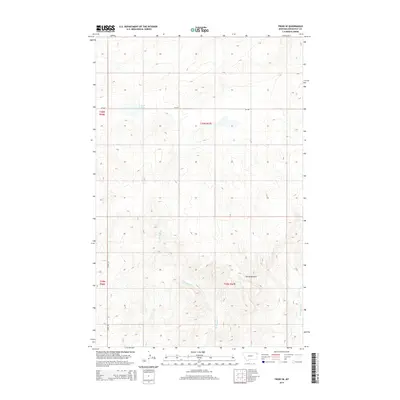
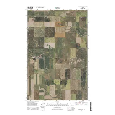
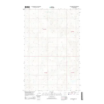
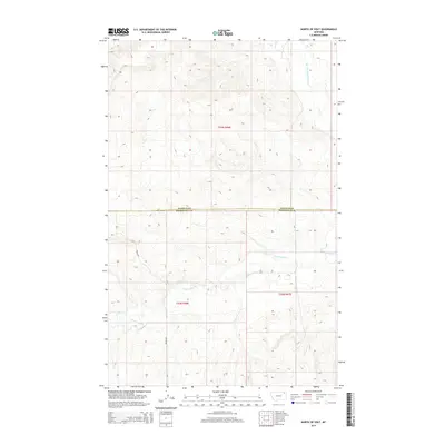
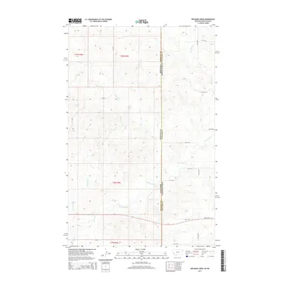
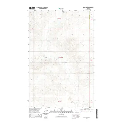
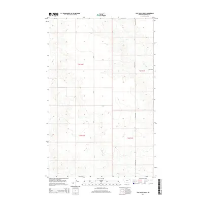
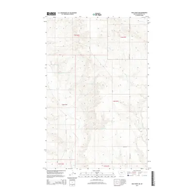
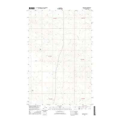
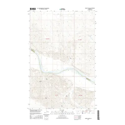
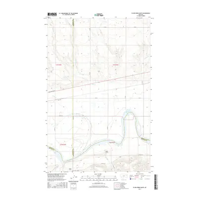
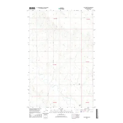
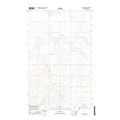
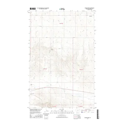
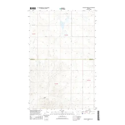
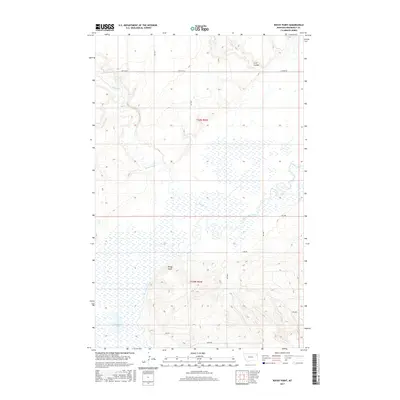
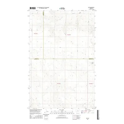
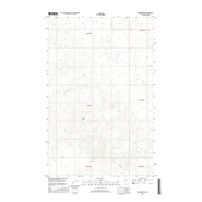
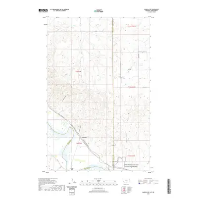
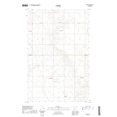
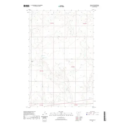
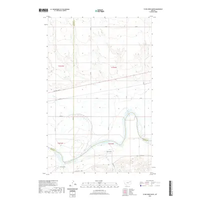
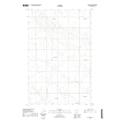
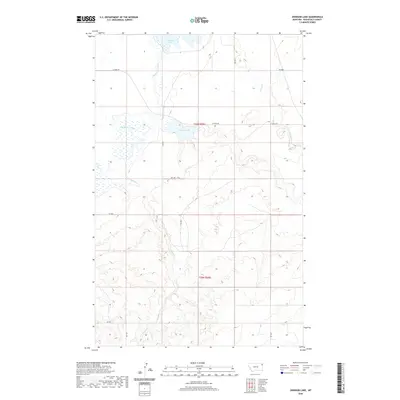
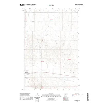
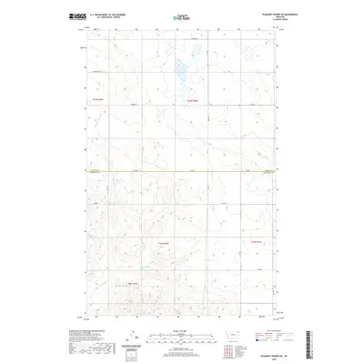
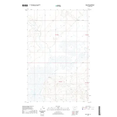
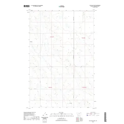
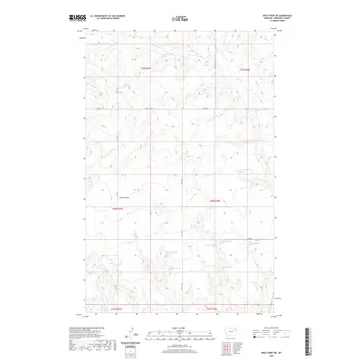
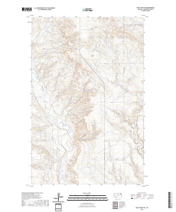
1972 Map of Wolf Point NW
USGS Topo · Published 1976About this map
Wolf Creek and Little Wolf Creek define this section of the Missouri River plateau within the Fort Peck Indian Reservation, as recorded in the early 1970s. The landscape is marked by the branching drainages of Tule Creek and numerous groundwater sources identified simply as Spring and Well. This era shows a land organized by the section lines of the public land survey system, with sparse industrial footprints like the Gravel Pits and Gravel Pit located in the northwest. Local infrastructure is minimal, represented by the West Fork No 2 site and a Radio Tower, reflecting the open, high-plains character of Roosevelt County before modern expansion. The map serves as a precise record of water access and topographical elevation in an area where such features were vital for ranching and local land management.
Find a feature on this map
9 named features on this map. Tap any name to fly to it.
Don’t see what you’re looking for? This feature index may not catch every label — zoom into the map to look around manually.
Map Details
Editions of this 1972 Wolf Point NW Map
This is the sole edition of this map. No revisions or reprints were ever made.
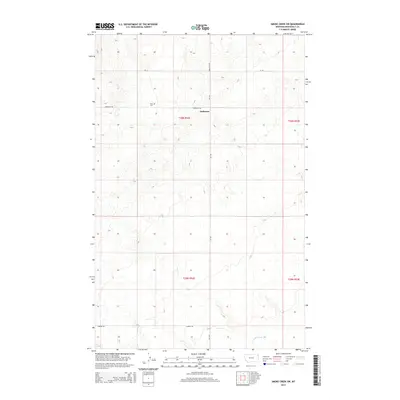
Historical Maps of Wolf Point District Through Time
274 maps found

1909 Smoke Creek
Roosevelt County, MT

1910 Cuskers
Roosevelt County, MT

1912 Chelsea
Roosevelt County, MT
1912 Hay Creek
Roosevelt County, MT

1912 Smoke Creek
Roosevelt County, MT

1915 Cuskers
Roosevelt County, MT

1915 Tule Valley
Roosevelt County, MT

1947 Rocky Point
Roosevelt County, MT

1948 Fort Kipp
Roosevelt County, MT

1948 Rocky Point
Roosevelt County, MT

1949 Fort Kipp
Roosevelt County, MT

1949 Johnson Lake
Roosevelt County, MT

1950 Calais
Roosevelt County, MT

1950 Coyote Coulee
Roosevelt County, MT

1950 Johnson Lake
Roosevelt County, MT
1968 Bainville SE
Roosevelt County, MT

1969 Bainville SW
Roosevelt County, MT

1969 Cedar Coulee
Roosevelt County, MT

1972 Badger Creek
Roosevelt County, MT

1972 Chelsea NW
Roosevelt County, MT

1972 Chelsea
Roosevelt County, MT

1972 Flynn Creek North
Roosevelt County, MT

1972 Flynn Creek South
Roosevelt County, MT

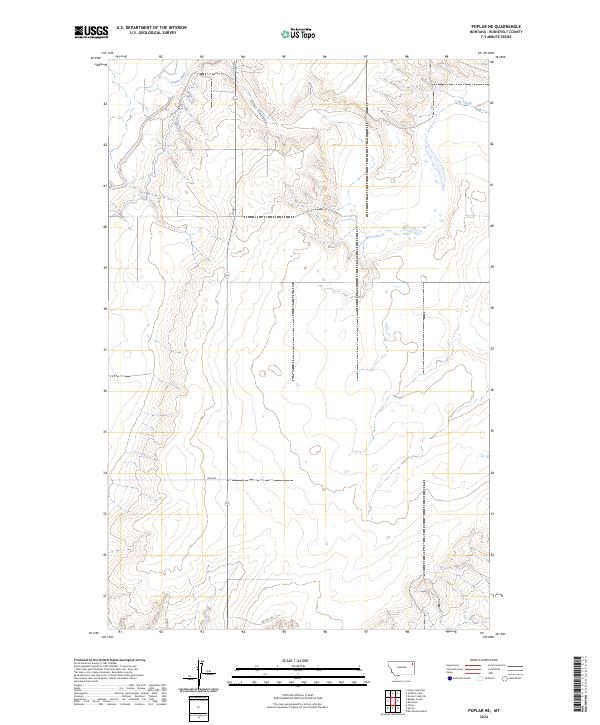
1972 Poplar NE
Roosevelt County, MT

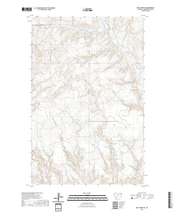
1972 Wolf Point NE
Roosevelt County, MT
1972 Wolf Point NW
Roosevelt County, MT

1973 Bredette
Roosevelt County, MT

1973 Jakes Coulee
Roosevelt County, MT

1973 Nielsen Coulee
Roosevelt County, MT

1973 North of Volt
Roosevelt County, MT

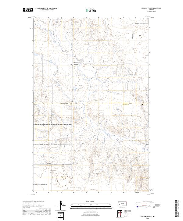
1973 Pleasant Prairie
Roosevelt County, MT

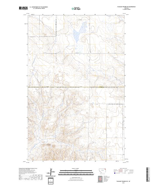
1973 Pleasant Prairie SW
Roosevelt County, MT

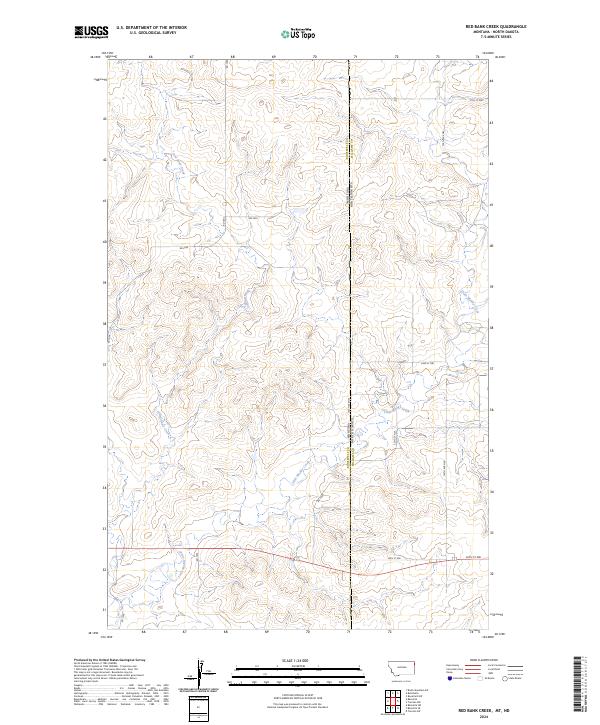
1974 Red Bank Creek
Roosevelt County, MT

1983 Beam School
Roosevelt County, MT
1983 Bears Nest
Roosevelt County, MT

1983 Brush Mountain SW
Roosevelt County, MT
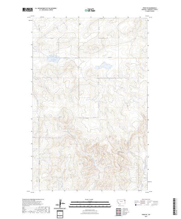
1983 Froid SE
Roosevelt County, MT

1983 Geddart Lake
Roosevelt County, MT

1983 Hay Creek NW
Roosevelt County, MT

1983 Hay Creek
Roosevelt County, MT

1983 Homestead NW
Roosevelt County, MT

1983 Long Creek East
Roosevelt County, MT

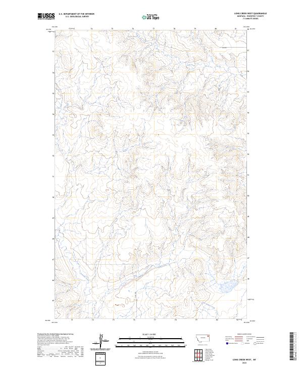
1983 Long Creek West
Roosevelt County, MT
1983 Mc Cabe East
Roosevelt County, MT

1983 Mc Cabe West
Roosevelt County, MT

1983 Reed Springs
Roosevelt County, MT

1983 Sims Spring
Roosevelt County, MT

1983 Smoke Creek NE
Roosevelt County, MT

1983 Smoke Creek SW
Roosevelt County, MT

1983 Soo
Roosevelt County, MT

1983 Tule Valley East
Roosevelt County, MT

1983 Tule Valley West
Roosevelt County, MT

1983 Volt
Roosevelt County, MT

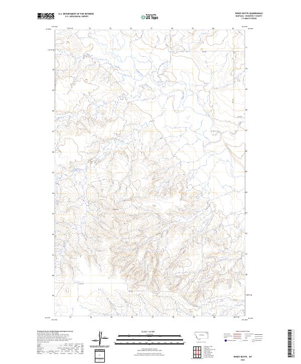
1983 Windy Butte
Roosevelt County, MT
2011 Badger Creek
Roosevelt County, MT
2011 Bainville SE
Roosevelt County, MT
2011 Bainville SW
Roosevelt County, MT
2011 Bears Nest
Roosevelt County, MT
2011 Biem School
Roosevelt County, MT
2011 Bredette
Roosevelt County, MT
2011 Brush Mountain SW
Roosevelt County, MT
2011 Calais
Roosevelt County, MT
2011 Cedar Coulee
Roosevelt County, MT
2011 Chelsea NW
Roosevelt County, MT
2011 Chelsea
Roosevelt County, MT
2011 Coyote Coulee
Roosevelt County, MT
2011 Flynn Creek North
Roosevelt County, MT
2011 Flynn Creek South
Roosevelt County, MT
2011 Fort Kipp
Roosevelt County, MT
2011 Froid SE
Roosevelt County, MT
2011 Geddart Lake
Roosevelt County, MT
2011 Hay Creek NW
Roosevelt County, MT
2011 Hay Creek
Roosevelt County, MT
2011 Homestead NW
Roosevelt County, MT
2011 Jakes Coulee
Roosevelt County, MT
2011 Johnson Lake
Roosevelt County, MT
2011 Long Creek East
Roosevelt County, MT
2011 Long Creek West
Roosevelt County, MT
2011 McCabe East
Roosevelt County, MT
2011 McCabe West
Roosevelt County, MT
2011 Nielsen Coulee
Roosevelt County, MT
2011 North of Volt
Roosevelt County, MT
2011 Pleasant Prairie
Roosevelt County, MT
2011 Pleasant Prairie SW
Roosevelt County, MT
2011 Poplar NE
Roosevelt County, MT
2011 Red Bank Creek
Roosevelt County, MT
2011 Reed Springs
Roosevelt County, MT
2011 Rocky Point
Roosevelt County, MT
2011 Sims Spring
Roosevelt County, MT
2011 Smoke Creek NE
Roosevelt County, MT
2011 Smoke Creek SW
Roosevelt County, MT
2011 Soo
Roosevelt County, MT
2011 Tule Valley East
Roosevelt County, MT
2011 Tule Valley West
Roosevelt County, MT
2011 Volt
Roosevelt County, MT
2011 Windy Butte
Roosevelt County, MT
2011 Wolf Point NE
Roosevelt County, MT
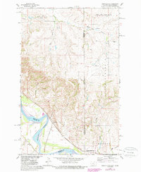
2011 Wolf Point NW
Roosevelt County, MT
2014 Badger Creek
Roosevelt County, MT
2014 Bainville SE
Roosevelt County, MT
2014 Bainville SW
Roosevelt County, MT
2014 Bears Nest
Roosevelt County, MT
2014 Biem School
Roosevelt County, MT
2014 Bredette
Roosevelt County, MT
2014 Brush Mountain SW
Roosevelt County, MT
2014 Calais
Roosevelt County, MT
2014 Cedar Coulee
Roosevelt County, MT
2014 Chelsea NW
Roosevelt County, MT
2014 Chelsea
Roosevelt County, MT
2014 Coyote Coulee
Roosevelt County, MT
2014 Flynn Creek North
Roosevelt County, MT
2014 Flynn Creek South
Roosevelt County, MT
2014 Fort Kipp
Roosevelt County, MT
2014 Froid SE
Roosevelt County, MT
2014 Geddart Lake
Roosevelt County, MT
2014 Hay Creek NW
Roosevelt County, MT
2014 Hay Creek
Roosevelt County, MT
2014 Homestead NW
Roosevelt County, MT
2014 Jakes Coulee
Roosevelt County, MT
2014 Johnson Lake
Roosevelt County, MT
2014 Long Creek East
Roosevelt County, MT
2014 Long Creek West
Roosevelt County, MT
2014 McCabe East
Roosevelt County, MT
2014 McCabe West
Roosevelt County, MT
2014 Nielsen Coulee
Roosevelt County, MT
2014 North of Volt
Roosevelt County, MT
2014 Pleasant Prairie
Roosevelt County, MT
2014 Pleasant Prairie SW
Roosevelt County, MT
2014 Poplar NE
Roosevelt County, MT
2014 Red Bank Creek
Roosevelt County, MT
2014 Reed Springs
Roosevelt County, MT
2014 Rocky Point
Roosevelt County, MT
2014 Sims Spring
Roosevelt County, MT
2014 Smoke Creek NE
Roosevelt County, MT
2014 Smoke Creek SW
Roosevelt County, MT
2014 Soo
Roosevelt County, MT
2014 Tule Valley East
Roosevelt County, MT
2014 Tule Valley West
Roosevelt County, MT
2014 Volt
Roosevelt County, MT
2014 Windy Butte
Roosevelt County, MT
2014 Wolf Point NE
Roosevelt County, MT
2014 Wolf Point NW
Roosevelt County, MT
2017 Badger Creek
Roosevelt County, MT
2017 Bainville SE
Roosevelt County, MT
2017 Bainville SW
Roosevelt County, MT
2017 Bears Nest
Roosevelt County, MT
2017 Biem School
Roosevelt County, MT

2017 Bredette
Roosevelt County, MT
2017 Brush Mountain SW
Roosevelt County, MT
2017 Calais
Roosevelt County, MT
2017 Cedar Coulee
Roosevelt County, MT
2017 Chelsea NW
Roosevelt County, MT
2017 Chelsea
Roosevelt County, MT
2017 Coyote Coulee
Roosevelt County, MT

2017 Flynn Creek North
Roosevelt County, MT
2017 Flynn Creek South
Roosevelt County, MT
2017 Fort Kipp
Roosevelt County, MT
2017 Froid SE
Roosevelt County, MT
2017 Geddart Lake
Roosevelt County, MT
2017 Hay Creek NW
Roosevelt County, MT
2017 Hay Creek
Roosevelt County, MT
2017 Homestead NW
Roosevelt County, MT
2017 Jakes Coulee
Roosevelt County, MT
2017 Johnson Lake
Roosevelt County, MT
2017 Long Creek East
Roosevelt County, MT
2017 Long Creek West
Roosevelt County, MT
2017 McCabe East
Roosevelt County, MT
2017 McCabe West
Roosevelt County, MT
2017 Nielsen Coulee
Roosevelt County, MT
2017 North of Volt
Roosevelt County, MT
2017 Pleasant Prairie
Roosevelt County, MT
2017 Pleasant Prairie SW
Roosevelt County, MT
2017 Poplar NE
Roosevelt County, MT
2017 Red Bank Creek
Roosevelt County, MT
2017 Reed Springs
Roosevelt County, MT
2017 Rocky Point
Roosevelt County, MT
2017 Sims Spring
Roosevelt County, MT
2017 Smoke Creek NE
Roosevelt County, MT
2017 Smoke Creek SW
Roosevelt County, MT
2017 Soo
Roosevelt County, MT
2017 Tule Valley East
Roosevelt County, MT
2017 Tule Valley West
Roosevelt County, MT
2017 Volt
Roosevelt County, MT
2017 Windy Butte
Roosevelt County, MT
2017 Wolf Point NE
Roosevelt County, MT
2017 Wolf Point NW
Roosevelt County, MT
2020 Badger Creek
Roosevelt County, MT
2020 Bainville SE
Roosevelt County, MT
2020 Bainville SW
Roosevelt County, MT
2020 Bears Nest
Roosevelt County, MT
2020 Biem School
Roosevelt County, MT
2020 Bredette
Roosevelt County, MT
2020 Brush Mountain SW
Roosevelt County, MT
2020 Calais
Roosevelt County, MT
2020 Cedar Coulee
Roosevelt County, MT
2020 Chelsea NW
Roosevelt County, MT
2020 Chelsea
Roosevelt County, MT
2020 Coyote Coulee
Roosevelt County, MT
2020 Flynn Creek North
Roosevelt County, MT
2020 Flynn Creek South
Roosevelt County, MT
2020 Fort Kipp
Roosevelt County, MT
2020 Froid SE
Roosevelt County, MT
2020 Geddart Lake
Roosevelt County, MT
2020 Hay Creek NW
Roosevelt County, MT
2020 Hay Creek
Roosevelt County, MT
2020 Homestead NW
Roosevelt County, MT
2020 Jakes Coulee
Roosevelt County, MT
2020 Johnson Lake
Roosevelt County, MT
2020 Long Creek East
Roosevelt County, MT
2020 Long Creek West
Roosevelt County, MT
2020 McCabe East
Roosevelt County, MT
2020 McCabe West
Roosevelt County, MT
2020 Nielsen Coulee
Roosevelt County, MT
2020 North of Volt
Roosevelt County, MT
2020 Pleasant Prairie
Roosevelt County, MT
2020 Pleasant Prairie SW
Roosevelt County, MT
2020 Poplar NE
Roosevelt County, MT
2020 Red Bank Creek
Roosevelt County, MT
2020 Reed Springs
Roosevelt County, MT
2020 Rocky Point
Roosevelt County, MT
2020 Sims Spring
Roosevelt County, MT

2020 Smoke Creek NE
Roosevelt County, MT
2020 Smoke Creek SW
Roosevelt County, MT
2020 Soo
Roosevelt County, MT
2020 Tule Valley East
Roosevelt County, MT
2020 Tule Valley West
Roosevelt County, MT
2020 Volt
Roosevelt County, MT
2020 Windy Butte
Roosevelt County, MT
2020 Wolf Point NE
Roosevelt County, MT
2020 Wolf Point NW
Roosevelt County, MT
2024 Badger Creek
Roosevelt County, MT
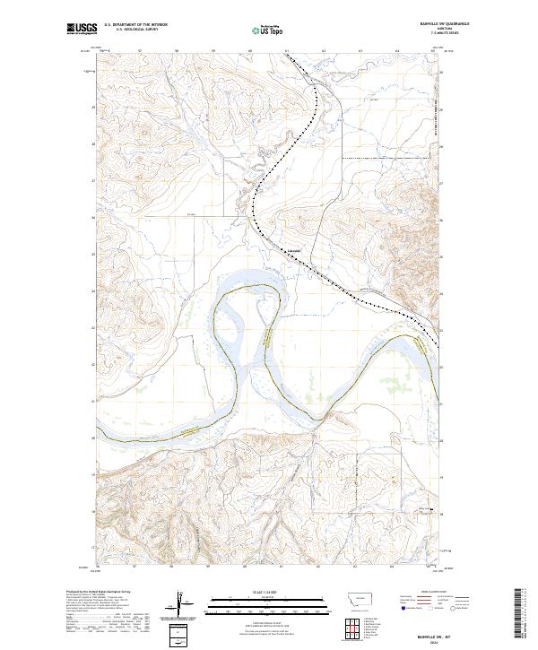
2024 Bainville SE
Roosevelt County, MT
2024 Bainville SW
Roosevelt County, MT
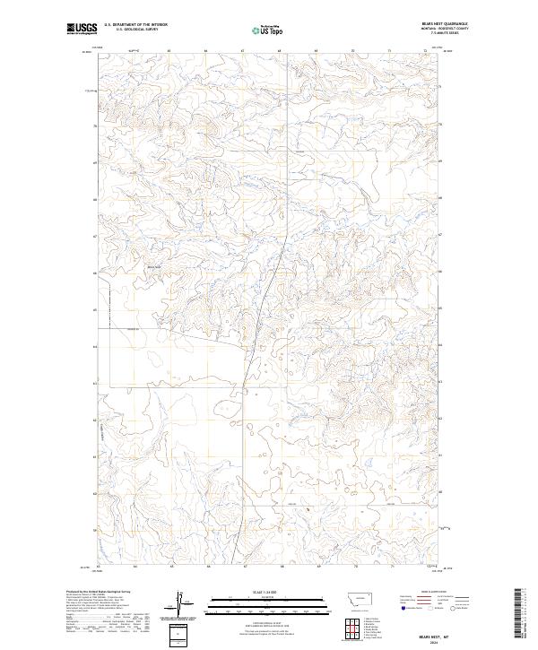
2024 Bears Nest
Roosevelt County, MT
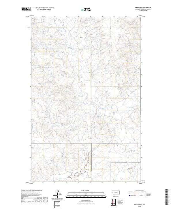
2024 Biem School
Roosevelt County, MT
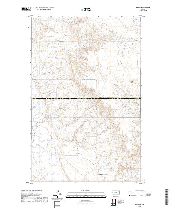
2024 Bredette
Roosevelt County, MT
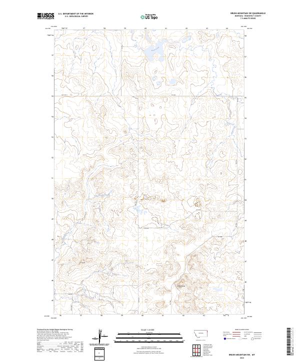
2024 Brush Mountain SW
Roosevelt County, MT
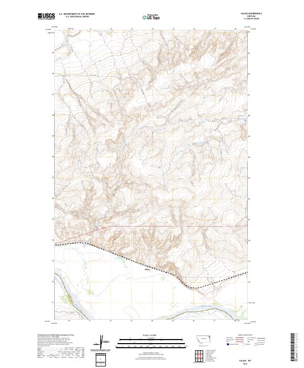
2024 Calais
Roosevelt County, MT
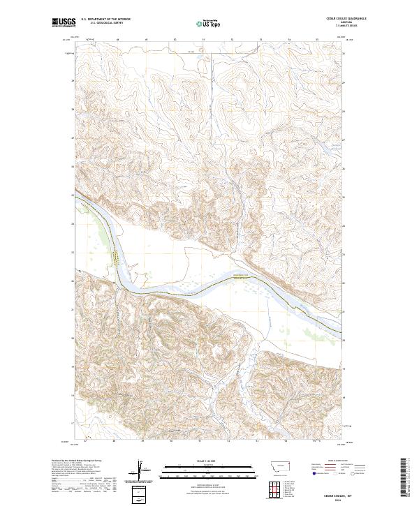
2024 Cedar Coulee
Roosevelt County, MT
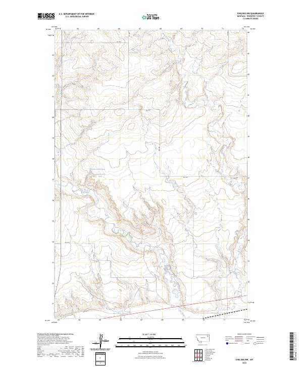
2024 Chelsea NW
Roosevelt County, MT
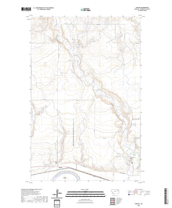
2024 Chelsea
Roosevelt County, MT
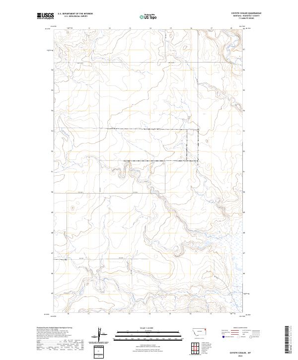
2024 Coyote Coulee
Roosevelt County, MT
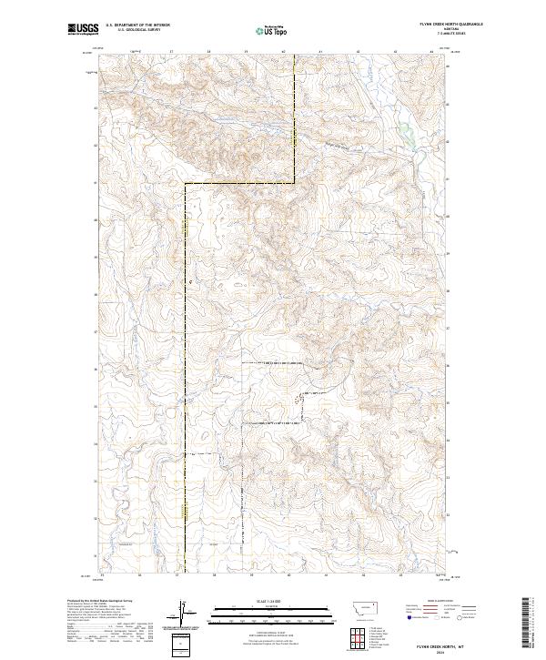
2024 Flynn Creek North
Roosevelt County, MT

2024 Flynn Creek South
Roosevelt County, MT
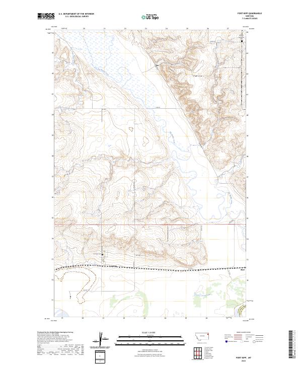
2024 Fort Kipp
Roosevelt County, MT
2024 Froid SE
Roosevelt County, MT
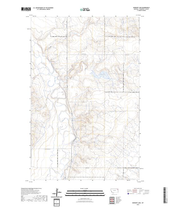
2024 Geddart Lake
Roosevelt County, MT
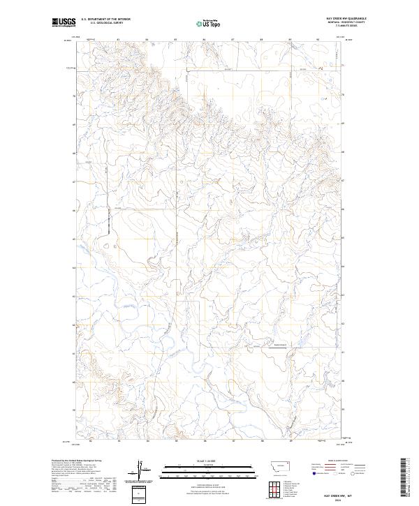
2024 Hay Creek NW
Roosevelt County, MT
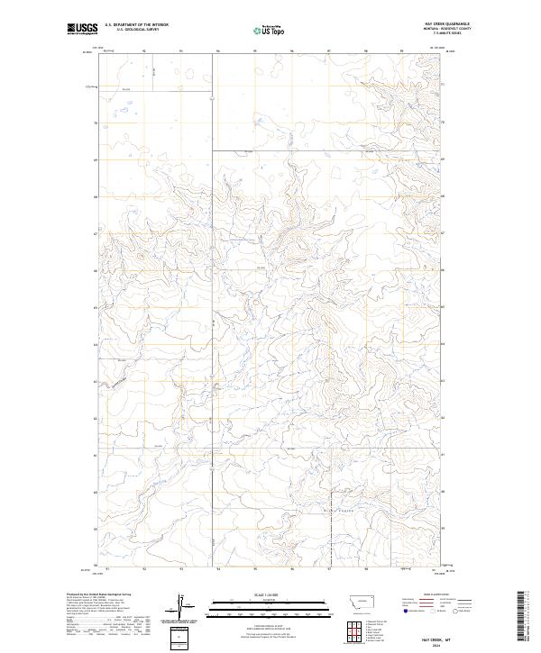
2024 Hay Creek
Roosevelt County, MT
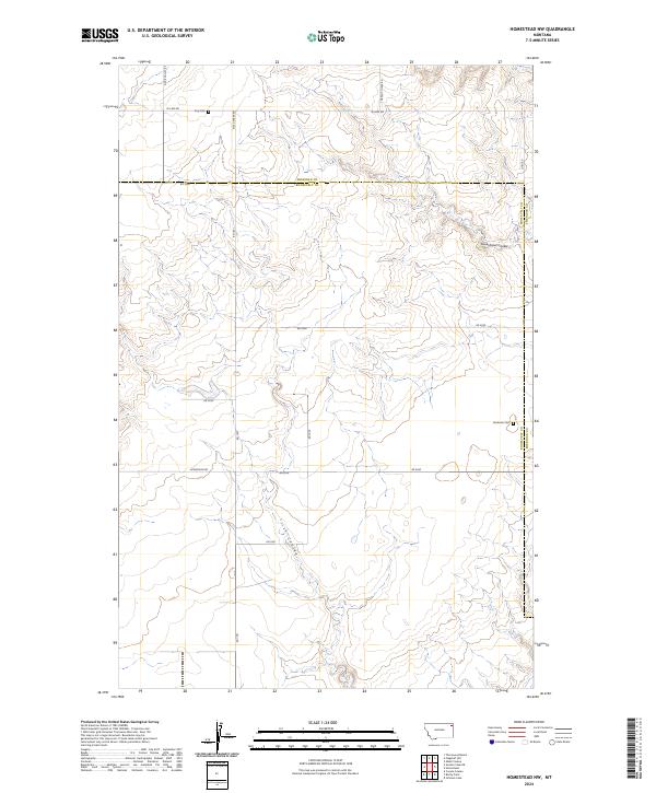
2024 Homestead NW
Roosevelt County, MT
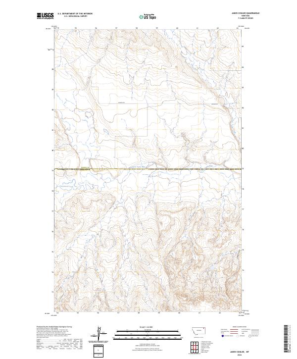
2024 Jakes Coulee
Roosevelt County, MT
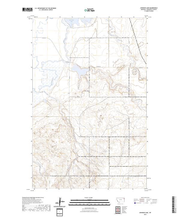
2024 Johnson Lake
Roosevelt County, MT
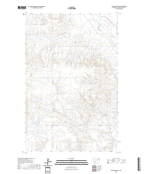
2024 Long Creek East
Roosevelt County, MT
2024 Long Creek West
Roosevelt County, MT
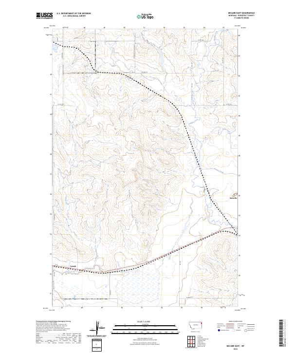
2024 McCabe East
Roosevelt County, MT

2024 McCabe West
Roosevelt County, MT
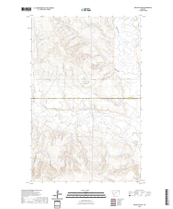
2024 Nielsen Coulee
Roosevelt County, MT
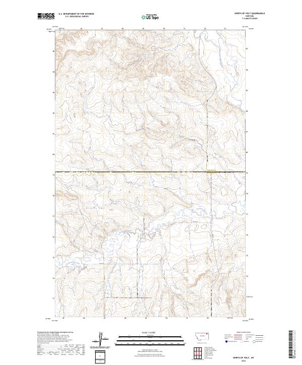
2024 North of Volt
Roosevelt County, MT
2024 Pleasant Prairie
Roosevelt County, MT
2024 Pleasant Prairie SW
Roosevelt County, MT
2024 Poplar NE
Roosevelt County, MT
2024 Red Bank Creek
Roosevelt County, MT
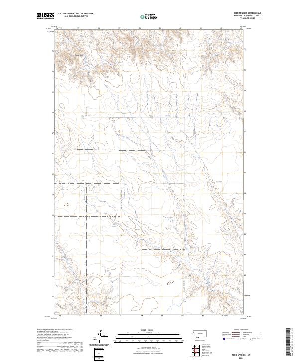
2024 Reed Springs
Roosevelt County, MT
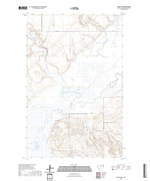
2024 Rocky Point
Roosevelt County, MT
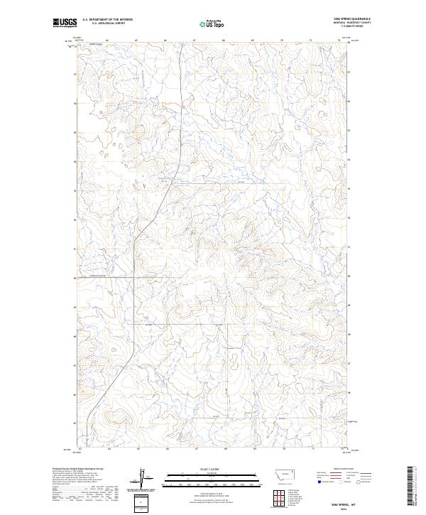
2024 Sims Spring
Roosevelt County, MT
2024 Smoke Creek NE
Roosevelt County, MT

2024 Smoke Creek SW
Roosevelt County, MT
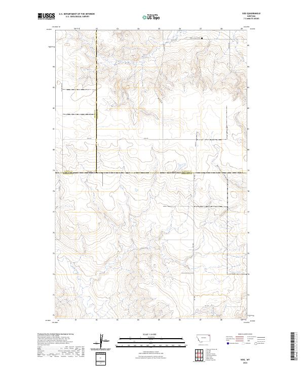
2024 Soo
Roosevelt County, MT
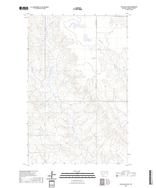
2024 Tule Valley East
Roosevelt County, MT
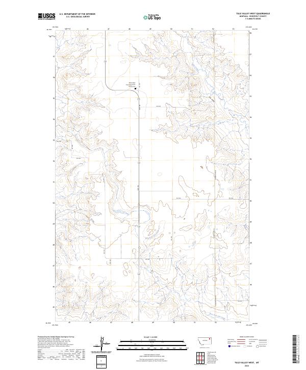
2024 Tule Valley West
Roosevelt County, MT
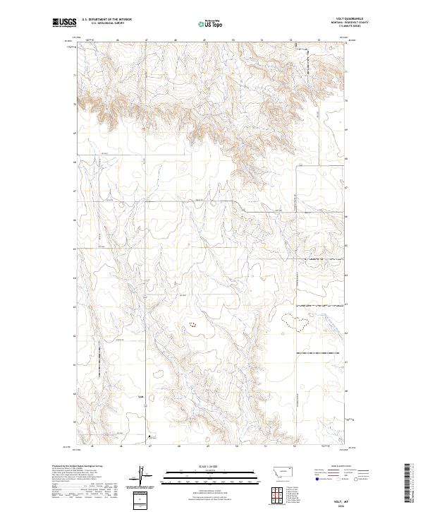
2024 Volt
Roosevelt County, MT
2024 Windy Butte
Roosevelt County, MT
2024 Wolf Point NE
Roosevelt County, MT
2024 Wolf Point NW
Roosevelt County, MT