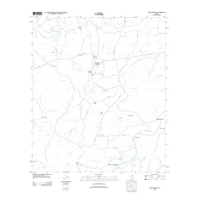
2012 Map of Wolf Ridge
USGS Topo · Published 2012About this map
Red Bluff Crossing and the Colorado River define this central Texas landscape, where the river winds through a terrain of distinct hollows and bluffs. The map documents a traditional ranching and rural economy, anchored by the Robinson Ranch and historic sites such as Parks Mill. The convergence of the San Saba River and Colorado highlights the area's importance as a natural crossroads, reinforced by several named river crossings like Hicks Crossing and Rough Creek Crossing.
Find a feature on this map
55 named features on this map. Tap any name to fly to it.
Don’t see what you’re looking for? This feature index may not catch every label — zoom into the map to look around manually.
Map Details
Editions of this 2012 Wolf Ridge Map
This is the sole edition of this map. No revisions or reprints were ever made.
Other maps of this area

1885 · San Saba
USGS Topo · 1:125,000

1887 · Lampasas
USGS Topo · 1:125,000

1894 · Lampasas
USGS Topo · 1:125,000

1894 · San Saba
USGS Topo · 1:125,000

1925 · San Saba 4-a
USGS Topo · 1:48,000

1925 · San Saba 1-c
USGS Topo · 1:48,000

1925 · San Saba 1-d
USGS Topo · 1:48,000

1928 · Goldthwaite
USGS Topo · 1:62,500

1931 · Bend
USGS Topo · 1:62,500

1948 · Goldthwaite
USGS Topo · 1:62,500