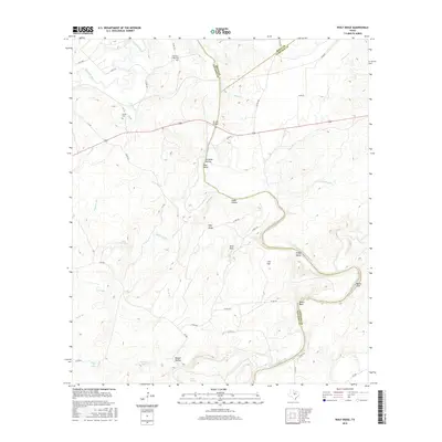
2016 Map of Wolf Ridge
USGS Topo · Published 2016About this map
The confluence of central Texas geography is on display here as the San Saba River and the Colorado River wind through the limestone-cut landscape at the intersection of San Saba, Mills, and Lampasas Counties. This terrain is defined by dramatic elevation shifts and natural landmarks like Raven Bluff and Red Bluff, which overlook the sweeping bends of the rivers. The distribution of family-scale heritage is evident in the placement of Harmony Ridge Cem and Harris Cem, providing vital points of interest for genealogists tracing early residents of this river-bound region. The modern infrastructure of the US 190 Bridge serves as a primary crossing point, while numerous seasonal draws such as Traywick Br and Burnt Br carve through the named uplands of Wolf Ridge and Lick Flat.
Find a feature on this map
57 named features on this map. Tap any name to fly to it.
Don’t see what you’re looking for? This feature index may not catch every label — zoom into the map to look around manually.
Map Details
Editions of this 2016 Wolf Ridge Map
This is the sole edition of this map. No revisions or reprints were ever made.
Other maps of this area

1885 · San Saba
USGS Topo · 1:125,000

1887 · Lampasas
USGS Topo · 1:125,000

1894 · Lampasas
USGS Topo · 1:125,000

1894 · San Saba
USGS Topo · 1:125,000

1925 · San Saba 4-a
USGS Topo · 1:48,000

1925 · San Saba 1-c
USGS Topo · 1:48,000

1925 · San Saba 1-d
USGS Topo · 1:48,000

1928 · Goldthwaite
USGS Topo · 1:62,500

1931 · Bend
USGS Topo · 1:62,500

1948 · Goldthwaite
USGS Topo · 1:62,500